Where the Autopista Ends
Two motorcycle bloggers in the San Francisco Bay Area.
Driving in the Post-Apocalypse
Posted on February 9, 2014
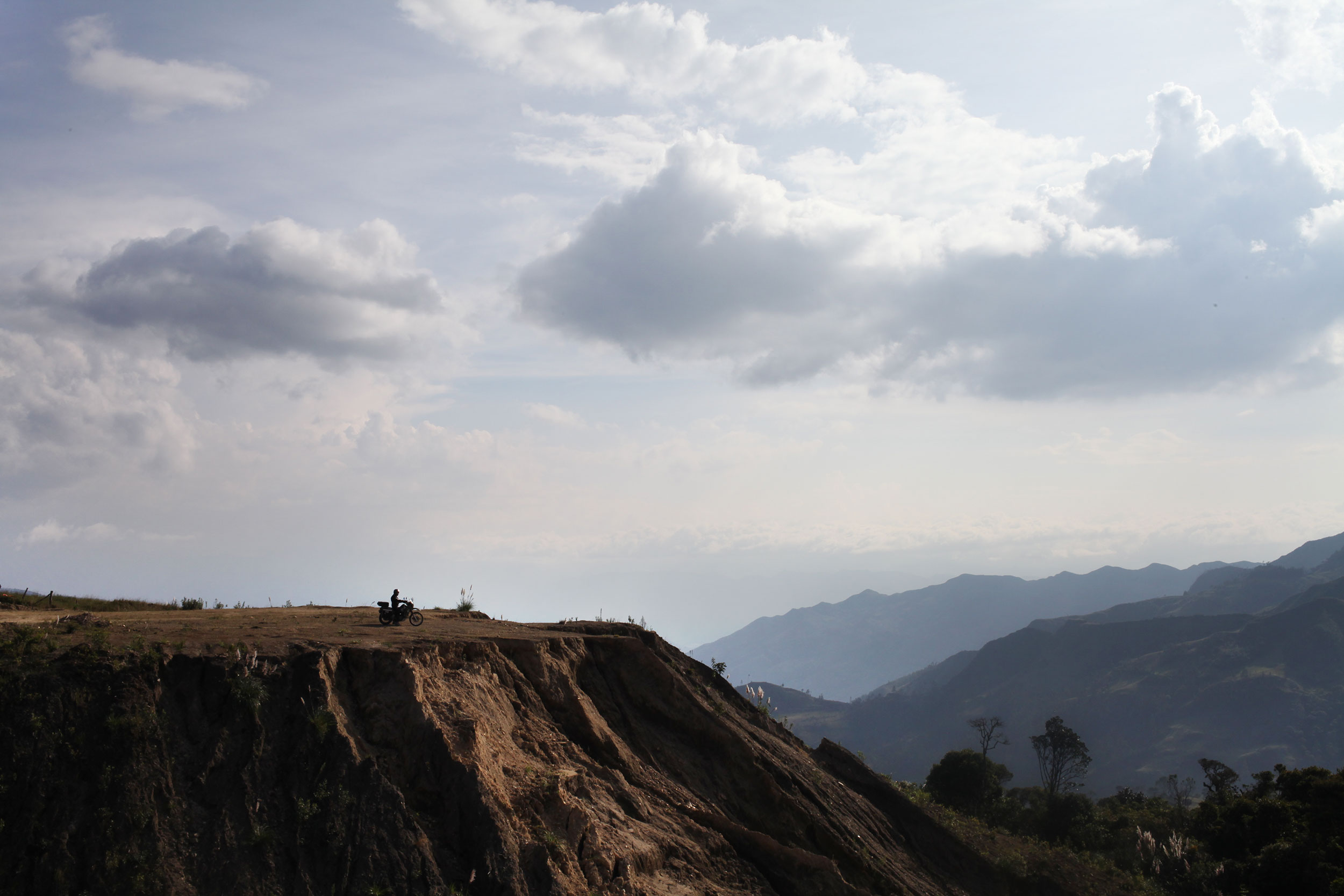
One of our last views of Ecuador. Photo: Alex Washburn
After our restful time in Cuenca, it was time to pack the bags and hit the road. We thought we could make it out of Ecuador in one day, but seeing as half of the country has the Andes mountain range running through it, you can’t make it anywhere very quickly.
In Mexico we weren’t happy with anything less than a 200 mile day, but when hairpins and s-curves, climbing then descending then climbing again, and dodging trucks (and stray dogs) is the norm you’re happy with a 100 miles. However, the day before our last day in Ecuador we saw some of the best scenery in the whole country, rolling green mountains, and just enough curves to have fun on without slowing you down.
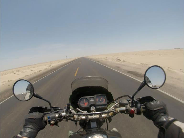
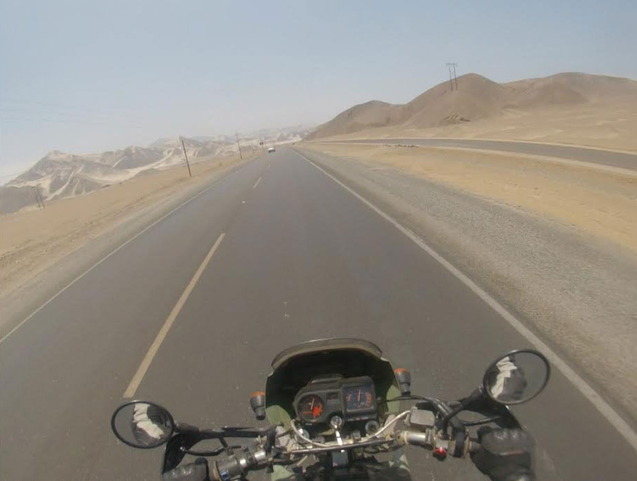
Northern Peru greets you with over 700 miles of this. Photo: Nathaniel Chaney
Research is a must before every border crossing! Even if it is just to see pictures of where the buildings are (many crossing in Central America have the buildings in illogical places where they must be hunted out) and to know how much you might have to pay for insurance. In looking at the Ecuador-Peru border there seemed to be unity on the inter-webs as to its ease.
Leaving early and never knowing what to expect we headed to the border and in less than an hour and a half we were processed out of Ecuador and into Peru. This was the best border crossing of the whole trip, bar none. The Peruvian Aduana (customs) employees were friendly and helpful, two qualities you don’t find in many border officials, and a first of the trip, they even made copies for us of the paperwork they required!
Many of the countries that we have visited have shocked me in how different they are then I had imagined them. For instance, I always thought that Colombia was just one giant jungle. And don’t get me wrong, there is jungle there, but no country is one ecosystem, and the landscape of Colombia is one of the most diverse we have seen. With that said, northern Peru was exactly how I imagined it.
The coastal desert region of Peru covers roughly 73,000 square miles of land and reaches inland between 12 and 62 miles. It is known as the Sechura desert in the north. Photo: Alex Washburn
Ecuador is green, lush, and for a third world country, particularly trash free (Alex informed me later that there were anti-littering signs posted everywhere along the road). Northern Peru could not be any different, and was the most dramatic shift in environment we have experienced. The landscape is dry, arid desert spotted with a few towns. As you continue, the desert only intensifies into dunes that remind one of Tunisia.
We filled up with gas after the border, using the last of our cash, and continued on, hoping to hit an ATM at the first real town. Tambo Grande was the first larger town (i.e. not a cluster of huts along the road) that we stumbled upon and we went in search of an ATM. After driving through the whole town we stopped and Alex asked a passerby where we might find a cash machine. His response was that there wasn’t one in the entire town.
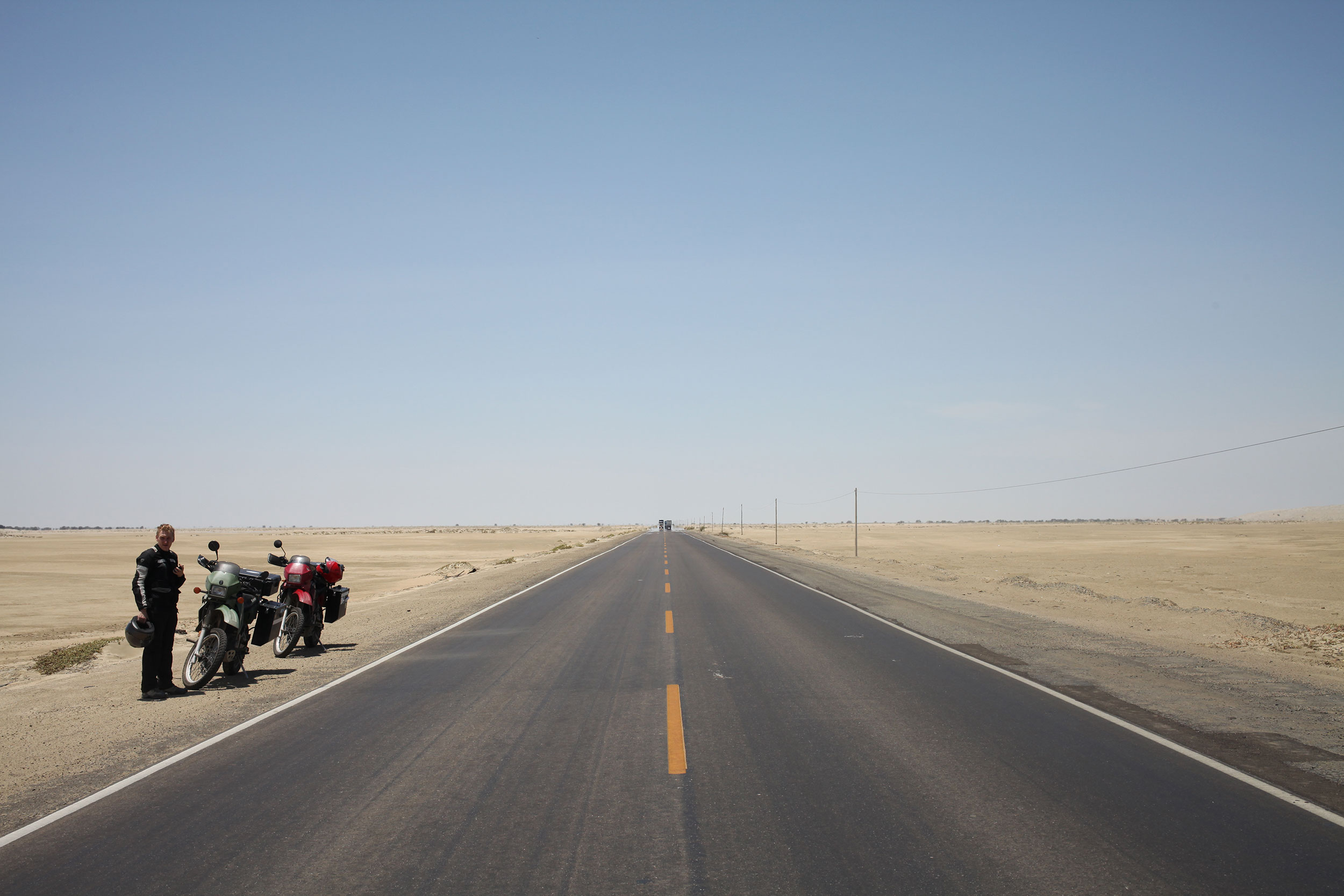
We got to a point on our first day rolling through the Sechura desert where we just slowed to a stop in awe of the nothingness surrounding us. Photo: Alex Washburn
Onward it was. Continuing through large swaths of dry desert and the occasional grouping of houses, that are more what people at home would think of as huts, on the sides of the freeway. We got to Piura (the first major town on the map) and here we struck pay dirt at a mall that had a line of ATMs from every major international bank. We decided to call it quits for the day and thankfully we did, because early the next morning we found out how long it was to the next town.
What started as brown dry desert reminiscent of Baja, California, gradually turned into dunes as we got further from Piura. The luck of that day was that we filled up before we left Piura, because once we were in the desert it was 120 miles to the next town. As we entered the Zonas de Dunas, the winds picked up and it was hours of riding with the bikes tilted at an angle, reflected in the small brush on the side of the road that had grown blown in one direction.
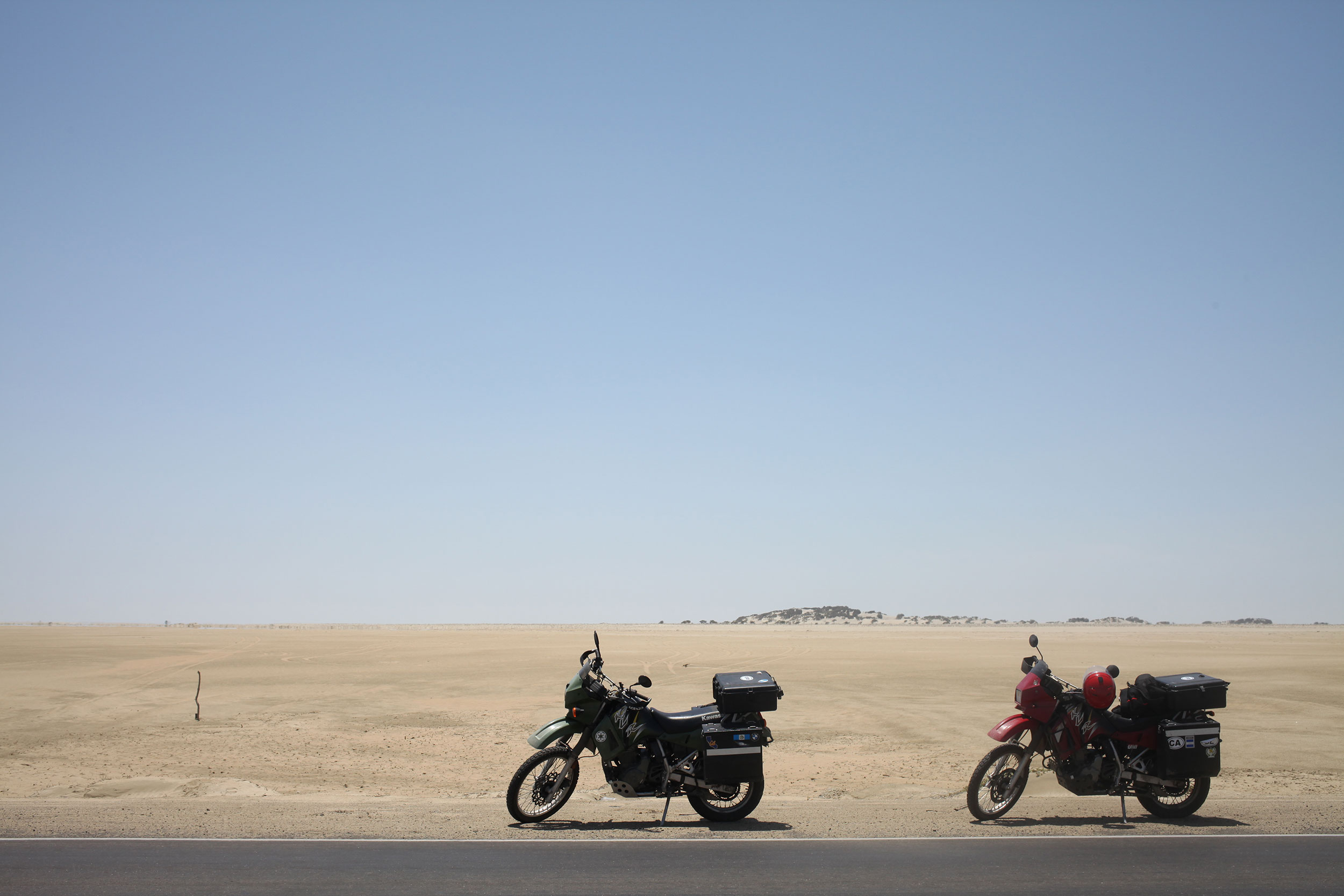
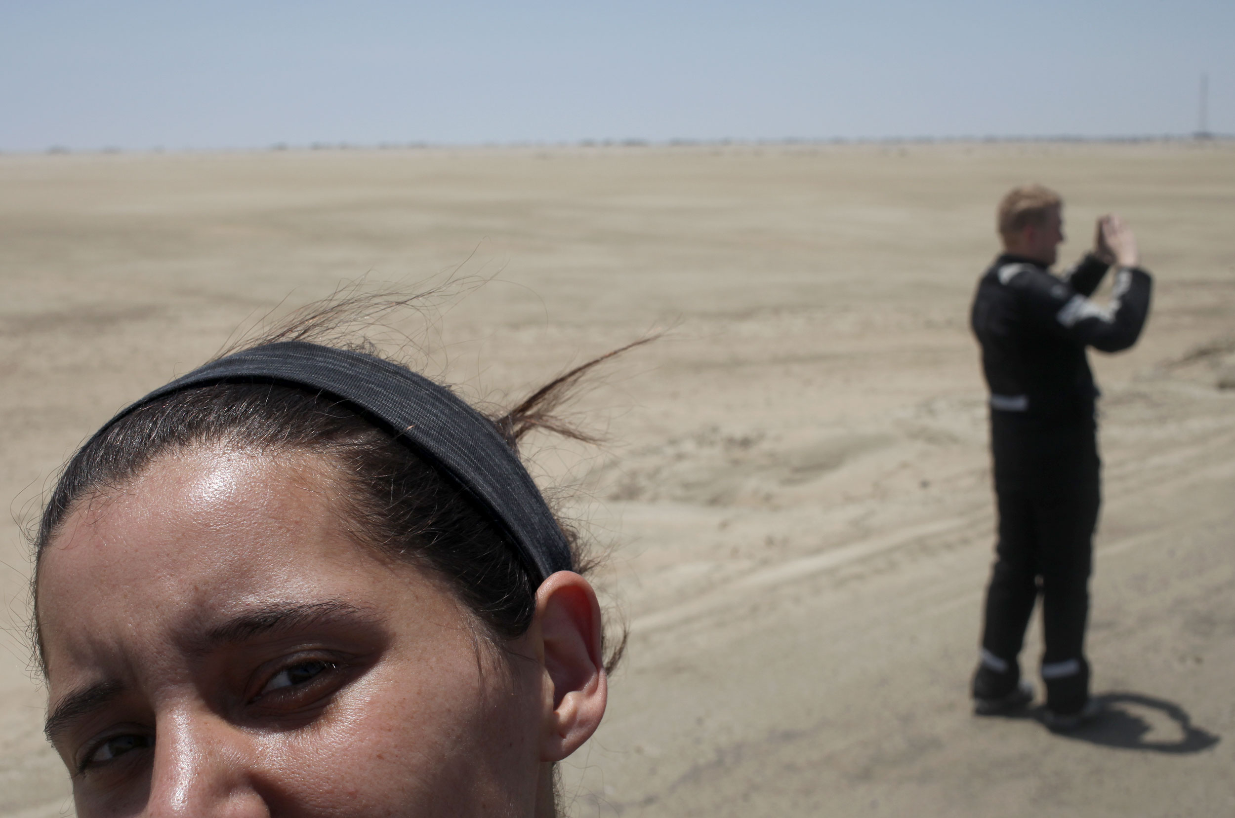
We stopped for a quick photo break 200 miles(isn) north of Lima. We were tired and dehydrated when we finally arrived although this desert is not actually that hot. Photo: Alex Washburn
What some people might not realize about this trip, or any trip on motorcycles, is that there are days where all you do is get up, and ride. It’s not a complaint, we have seen some of the best sights while on two wheels, but it is a reality I don’t think many people grasp. Riding into a town at dusk, looking for a hostel with parking (something you never worry about while backpacking), and only thinking about how much your ass hurts and that the overpowering, sometimes rancid, smell of your riding suit permeates every breath.
Get up the next morning, pack the bags, grab a bite and jump back on the bike for another full day. The dunes continue, going through small towns on a two lane road, dodging trucks and tuk-tuks. The sun is high in the sky, then low, then setting. The haze of evaporated water blends sky and earth and sand and road. A water color painting of a landscape that has no outstanding features. And we ride.
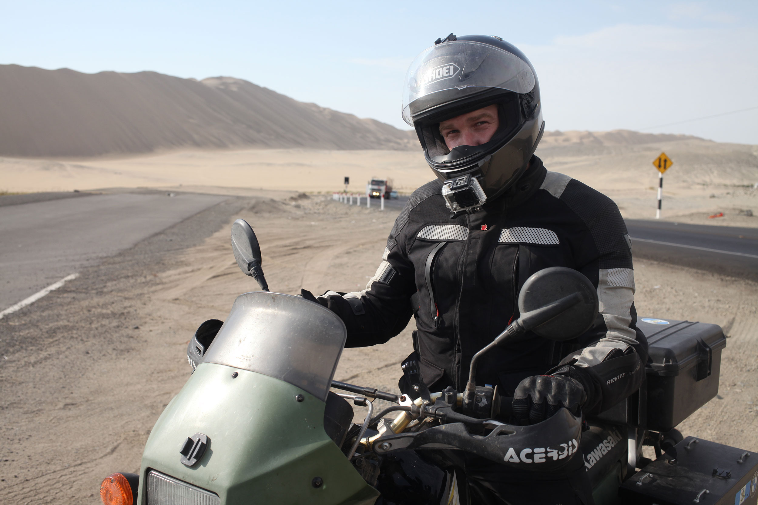
Nathaniel never takes photos of me so here is a selfie I shot with a 40mm. You’re welcome. Photo: Alex Washburn
Get up, pack, no breakfast, on the bikes. We make it to the ocean, dunes that lead right to the break. The towns become further apart. Stop when you can for food, for gas, for a break from the bike. Then more riding. The mirages stretche ahead, endless pools of nonexistent water, reminding you of the heat and the sand and the sun beating down. Sweat pools in your underwear, you can feel it every time you shift weight on the bike.
Even slight changes in scenery were exciting during our 700+ mile ride through the desert. Photo: Nathaniel Chaney
Its near the end of the third day that we hit a true stretch of freeway, not a two lane road, but an actual freeway and we twist the throttle and really open the bikes up. Ripping through the dunes, and the mountains of trash. What makes northern Peru look like a post-apocalyptic nightmare are the mounds of trash, which are usually on fire, that accompany the exit of every city.
Trash as far as the eye can see, with huts scattered throughout where people live and sift through the garbage. And then back into the desert of Mad Max the road warrior. The wind picks up, you tilt the bike, feel the sand sting that one spot your gloves and jacket have left unprotected. And the sun sets.
The final days ride brought us to Lima, our goal for the first leg of Peru.
Peruvians favorite part of the car is the horn, which they use instead of brakes or signals to inform others of the haphazard driving maneuvers they will perform that would churn the stomach of even the most talented of stunt drivers. Traffic be damned, Alex maneuvered us through the honks and sirens and shouts to our hostel, for a couple of days rest and some sight seeing before we get back on the bikes.
Bogota
Posted on January 23, 2014
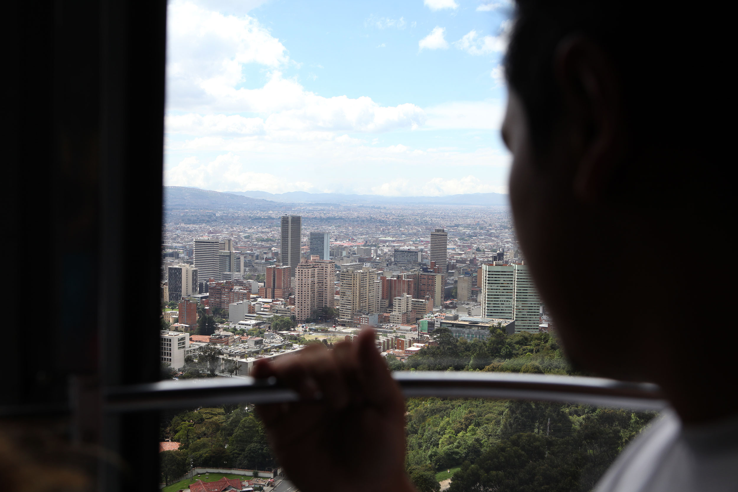
A man looks out over Bogota Colombia from the Transferico cable car that gives tourists and locals a view of the city from the top of a nearby mountain. Photo: Alex Washburn
Riding into Bogota, the capital of Columbia, was nothing like I expected. A few days earlier we had cruised into Bucaramanga, which you enter via mountain roads that give a view of the entire city as you crest them. This is what I expected when coming into Bogota, a city of 6.73 million people, but as Alex and I entered the city the limits, the city only slowly grew up around us.
In what reminded us of LA, and to a lesser extent Sacramento, Bogota is expansive, a main city built years ago that was expanded in the following decades. LA is 503 square miles, and Bogota is 613, which should give you an idea of how far it stretches. In a normal city the streets from north to south and east to west will be labeled Calle and Carrera, think street and avenue, and wont normally go past twenty or thirty. At the beginning of where Alex and I started we were at Calle 222, and we needed to get to Calle 9.

A group of tourists checks out a display at the Museo de Oro (Gold Museum) in downtown Bogota. Photo: Alex Washburn
Bogota brings together quaint neighborhoods, dirty trash heaps, museums, universities, street vendors, and churches in a way few other capital cities we have visited do. In La Candelaria, where our hostel was located (side-note: Musicology Hostel is one of the best hostels we have stayed at on this trip. The staff are friendly, the vibe is chill, and you can park a motorcycle in the entrance!) is the historic old town, full of churches and museums. It has a smaller town feel, until you ascend the church on Monserrate and get a full view of the city and how far it reaches.
While there could be many associations with Bogota, the City of Museums should be one. Within a six block radius of our hostel, there were at least five museums, and probably more that I am not aware of. There is the Military Museum, the Botero Museum, but the most prominent would be the Gold museum, which show cases gold workings from all over Colombia and easily has over 6,000 pieces on display. It can get a little overwhelming by the end and there are three sold floors of exhibits to peruse, though I was told Pablo Escobar’s gold Harley Davidson would be there and was slightly disappointed when I didn’t see it.
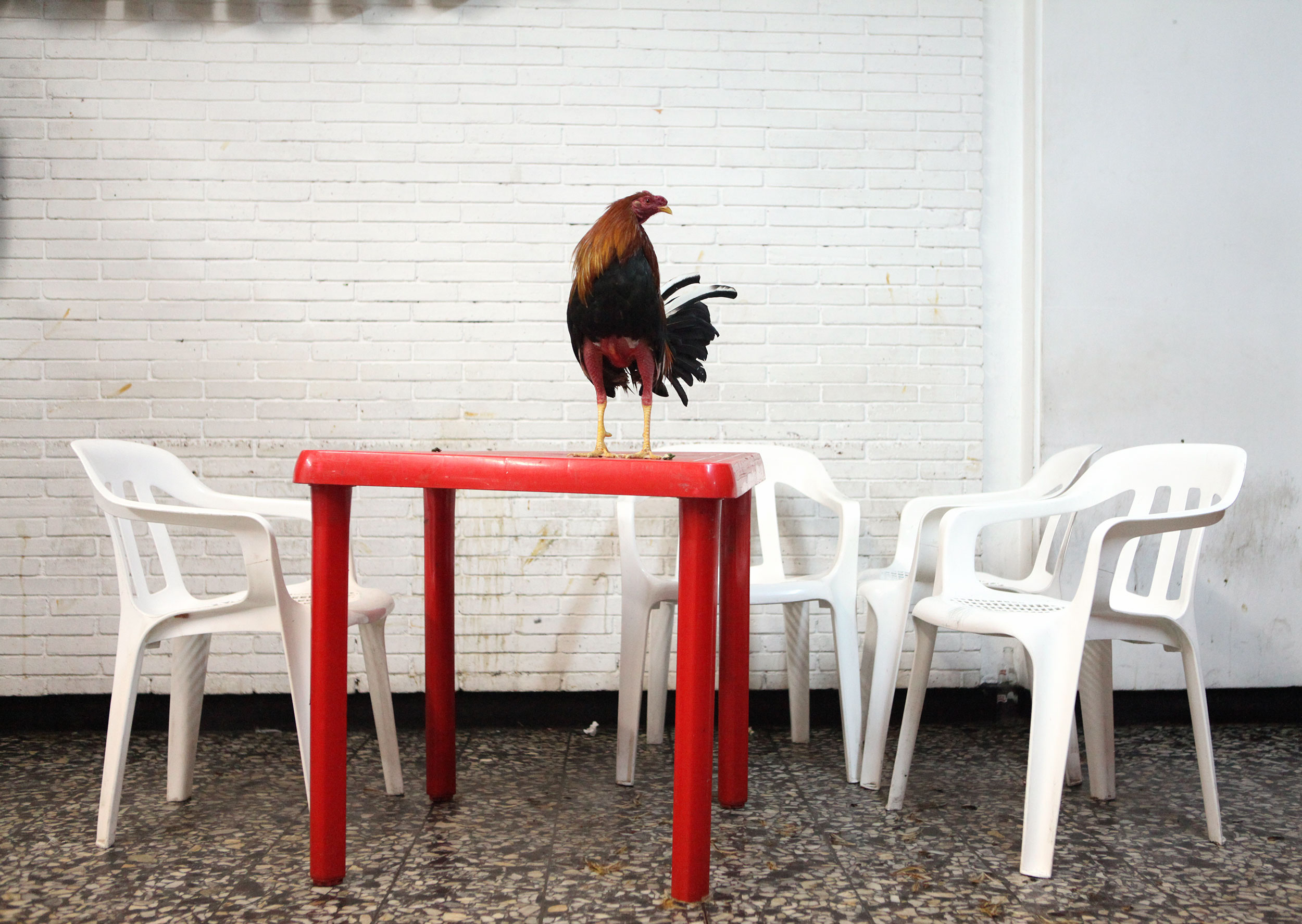
Alex being a photojournalist wanted to go to Club Gallistico and take photos. Club Gallistico is one of the oldest cockfighting establishments in the city and she’ll be doing a full post for that on her personal photoblog. Here a rooster waits to have fighting spurs attached to his feet. Photo: Alex Washburn
Bogota is located in a high plateau situated in the Andes mountain range, which means that it was a bit on the cold side even though it is middle of summer in South America. What helped to take the chill off was a local dish to the region, hot chocolate with cheese and bread with butter. We were a bit confused on how to eat the dish and ended up just dipping the cheese in the hot chocolate and nibbling on it only to find out later that you’re supposed to mix the cheese in and let it melt a little while you eat the bread and then drink the chocolate with the melted cheese inside of it.
As Alex mentioned in her previous post, there is a plethora of street food in Bogota, and many restaurants serving up traditional favorites such as Ajiaco (Colombian chicken soup) and tamals (think Mexican Tamales, but cooked in plantain leaves and considerably bigger with a softer form of masa). We weren’t left wanting once again for restaurants, but it is still hard to find good places among all the mediocrity, however asking locals and police officers never fails to produce results.
Bogota is so expansive you couldn’t ever explore all of it, from the historic downtown, to the more modern financial district (that has a building that at night would put Las Vegas to shame), to the outskirts with its apartments and neighborhoods. Alex and I enjoyed our time in Bogota, and thought it was the city that most surprised us thus far on the trip. Sure it is big and loud, like most capital cities, but there are treasures to be had if you put in the time to find them — and have a really great hostel to stay at!
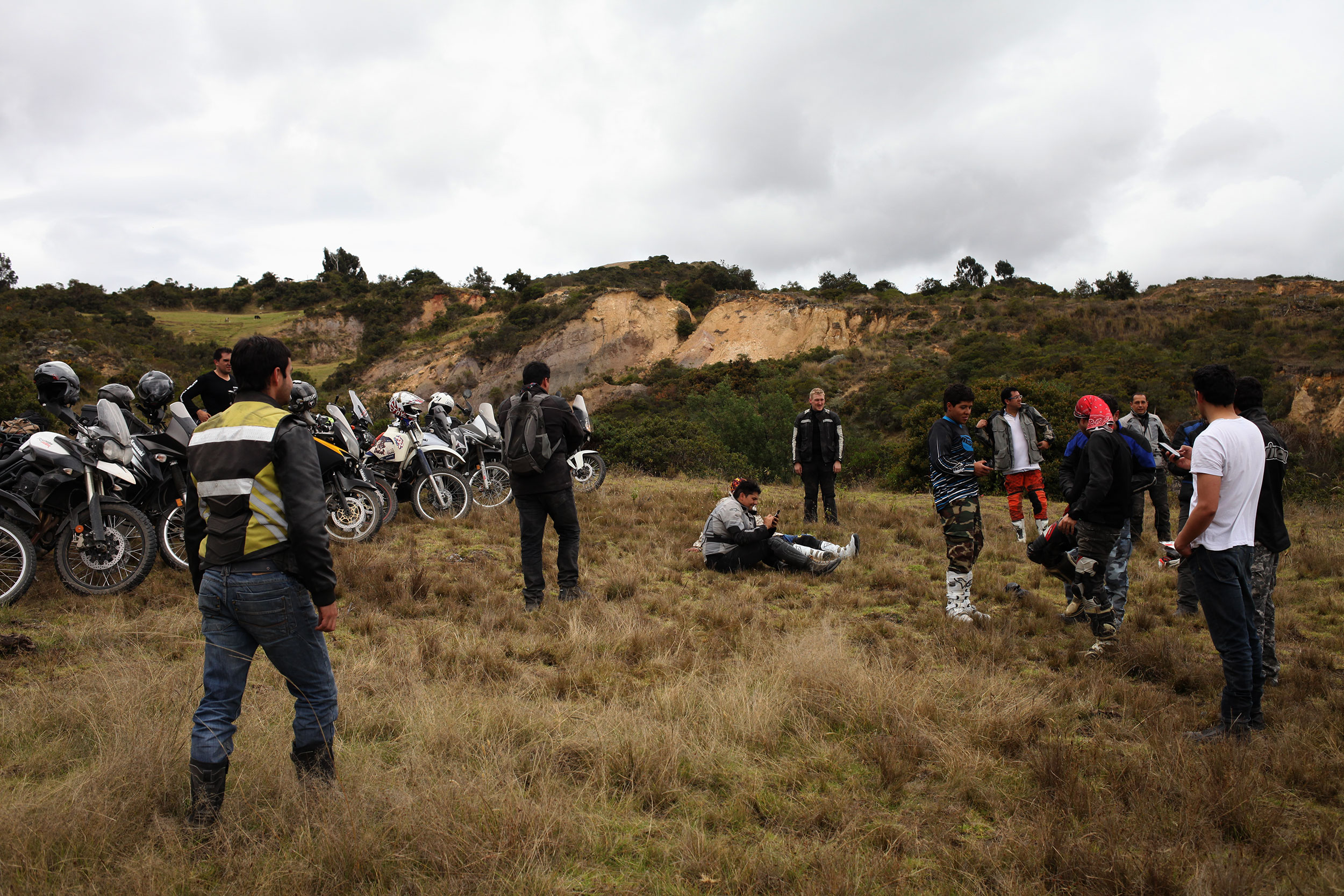
Our last full day in Bogota we met up with a group of Colombian motorcyclists and went off-roading just outside of Bogota. Alex has a ton of bruises from the adventure (full post on the ride tomorrow). Photo: Alex Washburn
A.T.T.C.C.
Posted on January 17, 2014
A.T.T.C.C. is A Tale of Two Colonial Cities. Colombia has two well known towns that are colonial to the bone, both well preserved since their founding and now a days keeping up appearances for tourists. The older of the two is Villa de Leyva founded in 1572 and the baby brother is Barichara founded in 1705. Both are promoted by Lonely Planet and as they are within driving distance (and on our way to Bogota) we decided to do a back to back comparison.
Barichara
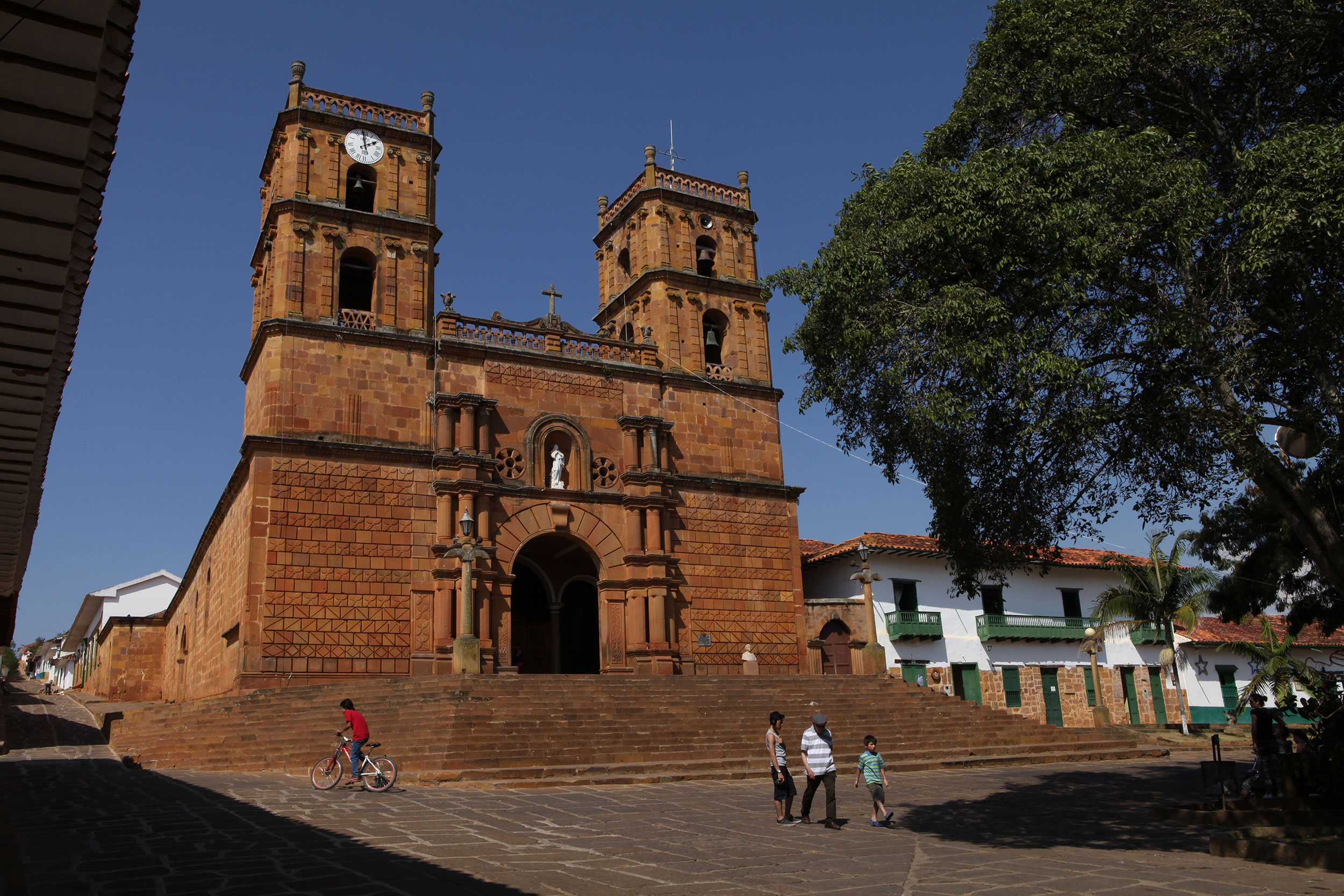
The Cathedral of Barichara dates back to 1705 and seems to dwarf the tiny puebla on the hillside. Photo: Alex Washburn
Barichara is located in the hills above San Gil, sitting atop a plateau that overlooks a dry valley below with a river running through. The landscape between San Gil and Barichara is pastoral bliss and once your in the town, it reminds one of the hills in Tuscany (our what I imagine they are like). The streets are cobblestone, but they have been cemented together, and though most likely slick when wet, it makes driving around on a motorcycle pleasant.
There is the sense that this isn’t just a tourist trap, but a real town nestled in the Colombian countryside. There are not an overwhelming amount of restaurants or knickknack shops, though there are more than enough cafes for some reason (this also is the case in Villa de Leyva). However, you see tons of locals on the streets, or sitting on stoups at night enjoying the country living.
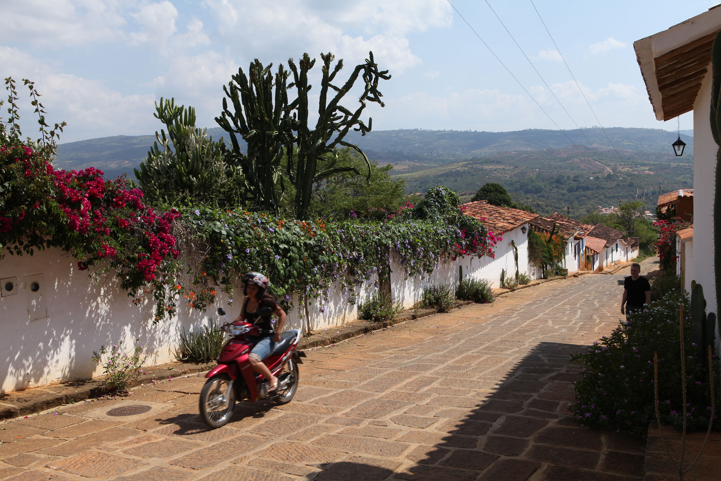
In Barichara you are always either walking up or down a hill. It creates lovely views from every street! Photo: Alex Washburn
Barichara is built on a hill and as you climb your way to the top the views of the surrounding valley only intensify, no matter which street you look down. The citizens and local government has done a great job of keeping up the facades of the houses and there is a cohesive feeling between the buildings that you would expect from a great colonial town.
There are three churches in town, the largest being Catedral de la Inmaculada Concepción, which is located in the main square of town. A couple of look out points on the west side gives great views of the valley, and the whole town can be traversed in under an hour at a lazy pace leaving plenty of time to sip a lemonada at one of the many mentioned cafes.
Sleepy, quite, and what you would want in a little getaway, though the lack of restaurants may leave you a little hungry at dinner time.
Villa de Leyva

The Plaza Mayor in Valle De Leyva is one of the biggest plazas in the Americas. It’s a huge open cobblestone square with a small fountain in the middle and a handful of eateries on its edges. Photo: Alex Washburn
On a dusty road off of Highway-62, between San Gil and Bogota, in a high valley lies Villa de Leyva. The valley, unlike the aird environment of Barichara, is lush and the ride reminded Alex of the hills in Switzerland. The whole town revolves around the Plaza Mayor, which is one of the largest in the Americas and does feel impressive when you stand in the middle.
White washed walls prevail throughout the town, and like Barichara, the architecture is consistent throughout. Villa de Leyva does have a feeling of being more developed, many cafes and trinket shops along with jewelry stores and clothing shops line the inner streets and near the outskirts there are shops where locals would do their shopping.
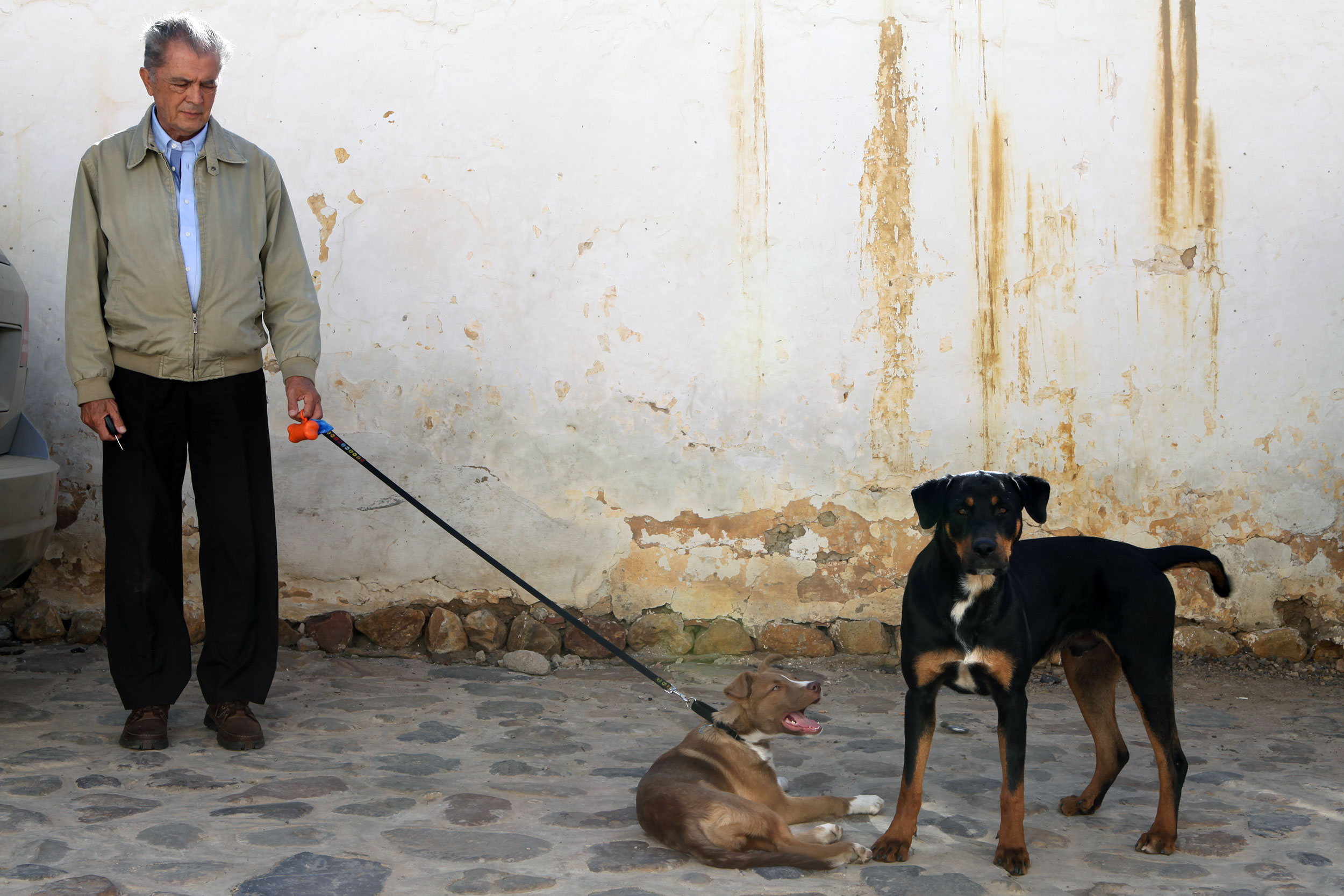
Villa De Leyva is full of people walking their dogs (some on leashes some not). It further adds to the quiet no-hurry atmosphere. Photo: Alex Washburn
The streets are cobblestone too, however laid in the traditional style, which makes driving a motorcycle on them…interesting. Upon entering town, Alex and I ended up going down a one way, the wrong way, and were told by cops to turned around. This is easier said than done on cobblestone, and an elderly gentleman came running up and helped pull us both backwards so we could turn around.
The town is about twice as big as Barichara, but there aren’t any more restaurants as one might expect. As in most smaller towns, stores tend to close early, and that might leave you without many options for dinner if you don’t plan ahead.
Lush, cobbley, and far from the bright lights of Bogota, it is a great escape from the larger cities, though the high altitude may have you reaching for a jacket instead of the sunscreen.
Both towns have hits and misses, Alex prefers Villa de Layva and I was more partial to Barichara. The best advice would be to hit up one or the other that fits best into your itinerary and then know that you got most of the experience of the other.
