Where the Autopista Ends
Two motorcycle bloggers in the San Francisco Bay Area.
Driving in the Post-Apocalypse
Posted on February 9, 2014
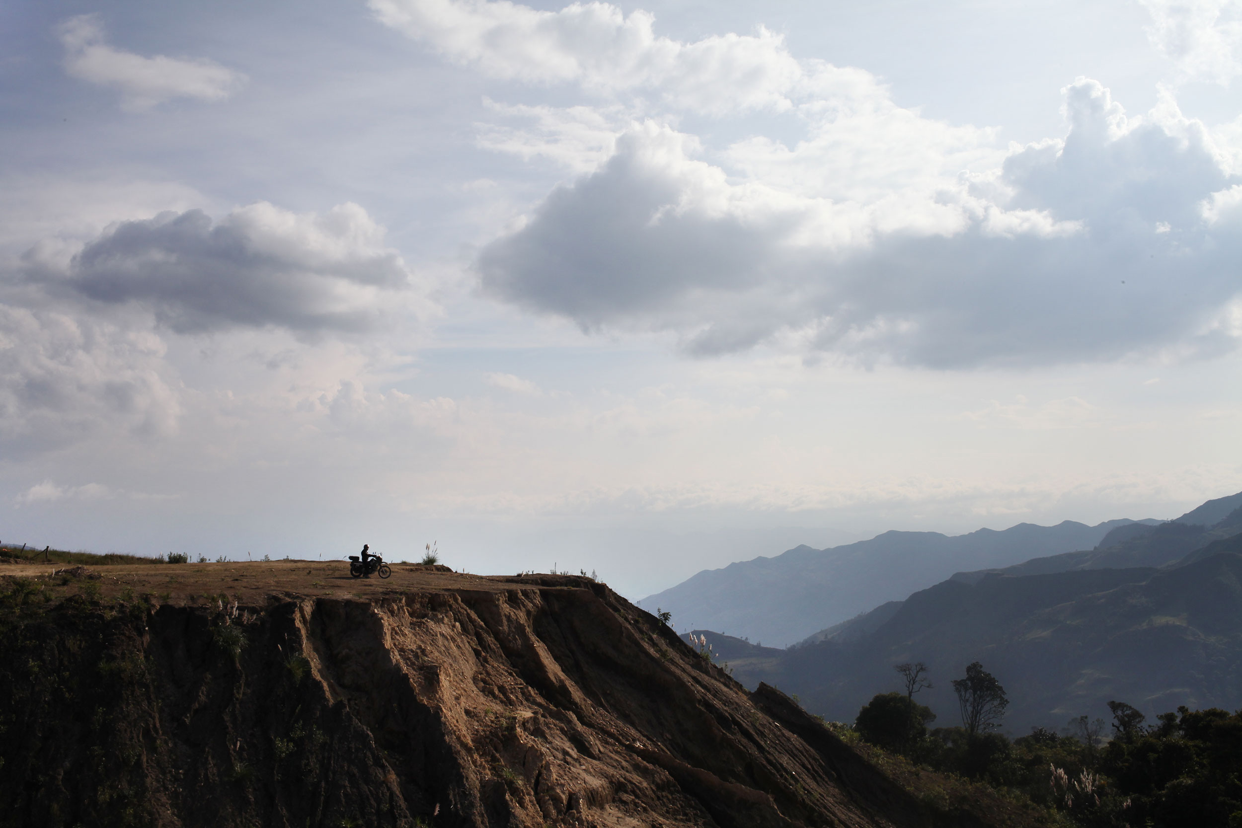
One of our last views of Ecuador. Photo: Alex Washburn
After our restful time in Cuenca, it was time to pack the bags and hit the road. We thought we could make it out of Ecuador in one day, but seeing as half of the country has the Andes mountain range running through it, you can’t make it anywhere very quickly.
In Mexico we weren’t happy with anything less than a 200 mile day, but when hairpins and s-curves, climbing then descending then climbing again, and dodging trucks (and stray dogs) is the norm you’re happy with a 100 miles. However, the day before our last day in Ecuador we saw some of the best scenery in the whole country, rolling green mountains, and just enough curves to have fun on without slowing you down.
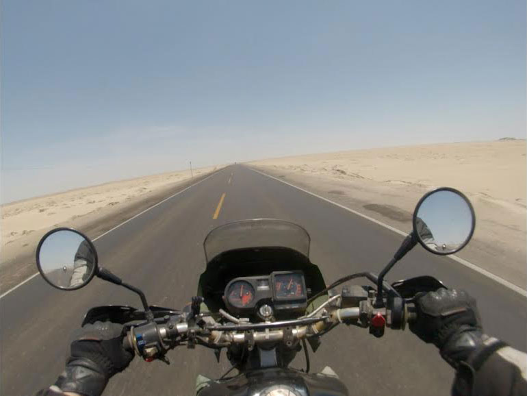
Northern Peru greets you with over 700 miles of this. Photo: Nathaniel Chaney
Research is a must before every border crossing! Even if it is just to see pictures of where the buildings are (many crossing in Central America have the buildings in illogical places where they must be hunted out) and to know how much you might have to pay for insurance. In looking at the Ecuador-Peru border there seemed to be unity on the inter-webs as to its ease.
Leaving early and never knowing what to expect we headed to the border and in less than an hour and a half we were processed out of Ecuador and into Peru. This was the best border crossing of the whole trip, bar none. The Peruvian Aduana (customs) employees were friendly and helpful, two qualities you don’t find in many border officials, and a first of the trip, they even made copies for us of the paperwork they required!
Many of the countries that we have visited have shocked me in how different they are then I had imagined them. For instance, I always thought that Colombia was just one giant jungle. And don’t get me wrong, there is jungle there, but no country is one ecosystem, and the landscape of Colombia is one of the most diverse we have seen. With that said, northern Peru was exactly how I imagined it.
The coastal desert region of Peru covers roughly 73,000 square miles of land and reaches inland between 12 and 62 miles. It is known as the Sechura desert in the north. Photo: Alex Washburn
Ecuador is green, lush, and for a third world country, particularly trash free (Alex informed me later that there were anti-littering signs posted everywhere along the road). Northern Peru could not be any different, and was the most dramatic shift in environment we have experienced. The landscape is dry, arid desert spotted with a few towns. As you continue, the desert only intensifies into dunes that remind one of Tunisia.
We filled up with gas after the border, using the last of our cash, and continued on, hoping to hit an ATM at the first real town. Tambo Grande was the first larger town (i.e. not a cluster of huts along the road) that we stumbled upon and we went in search of an ATM. After driving through the whole town we stopped and Alex asked a passerby where we might find a cash machine. His response was that there wasn’t one in the entire town.
We got to a point on our first day rolling through the Sechura desert where we just slowed to a stop in awe of the nothingness surrounding us. Photo: Alex Washburn
Onward it was. Continuing through large swaths of dry desert and the occasional grouping of houses, that are more what people at home would think of as huts, on the sides of the freeway. We got to Piura (the first major town on the map) and here we struck pay dirt at a mall that had a line of ATMs from every major international bank. We decided to call it quits for the day and thankfully we did, because early the next morning we found out how long it was to the next town.
What started as brown dry desert reminiscent of Baja, California, gradually turned into dunes as we got further from Piura. The luck of that day was that we filled up before we left Piura, because once we were in the desert it was 120 miles to the next town. As we entered the Zonas de Dunas, the winds picked up and it was hours of riding with the bikes tilted at an angle, reflected in the small brush on the side of the road that had grown blown in one direction.
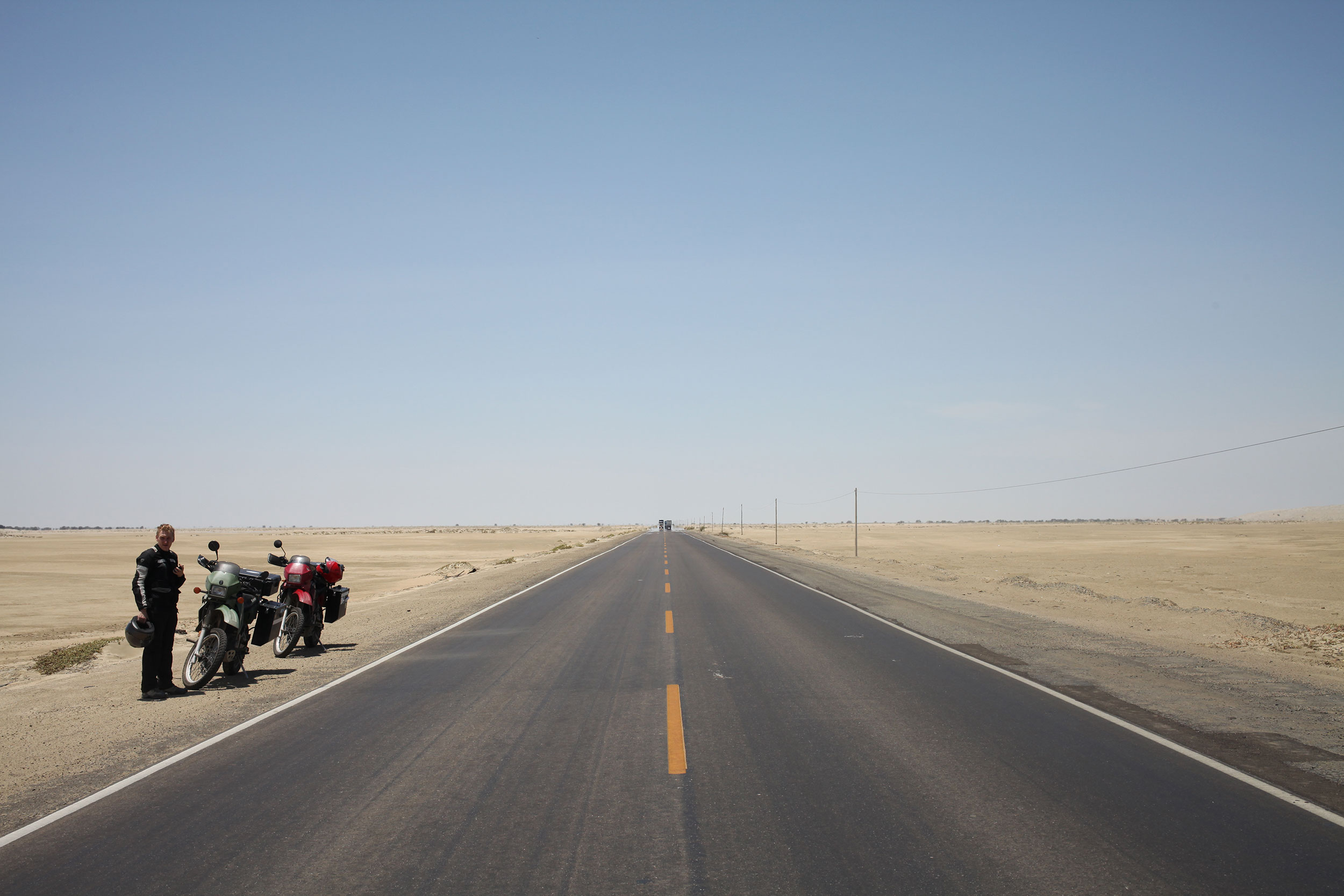
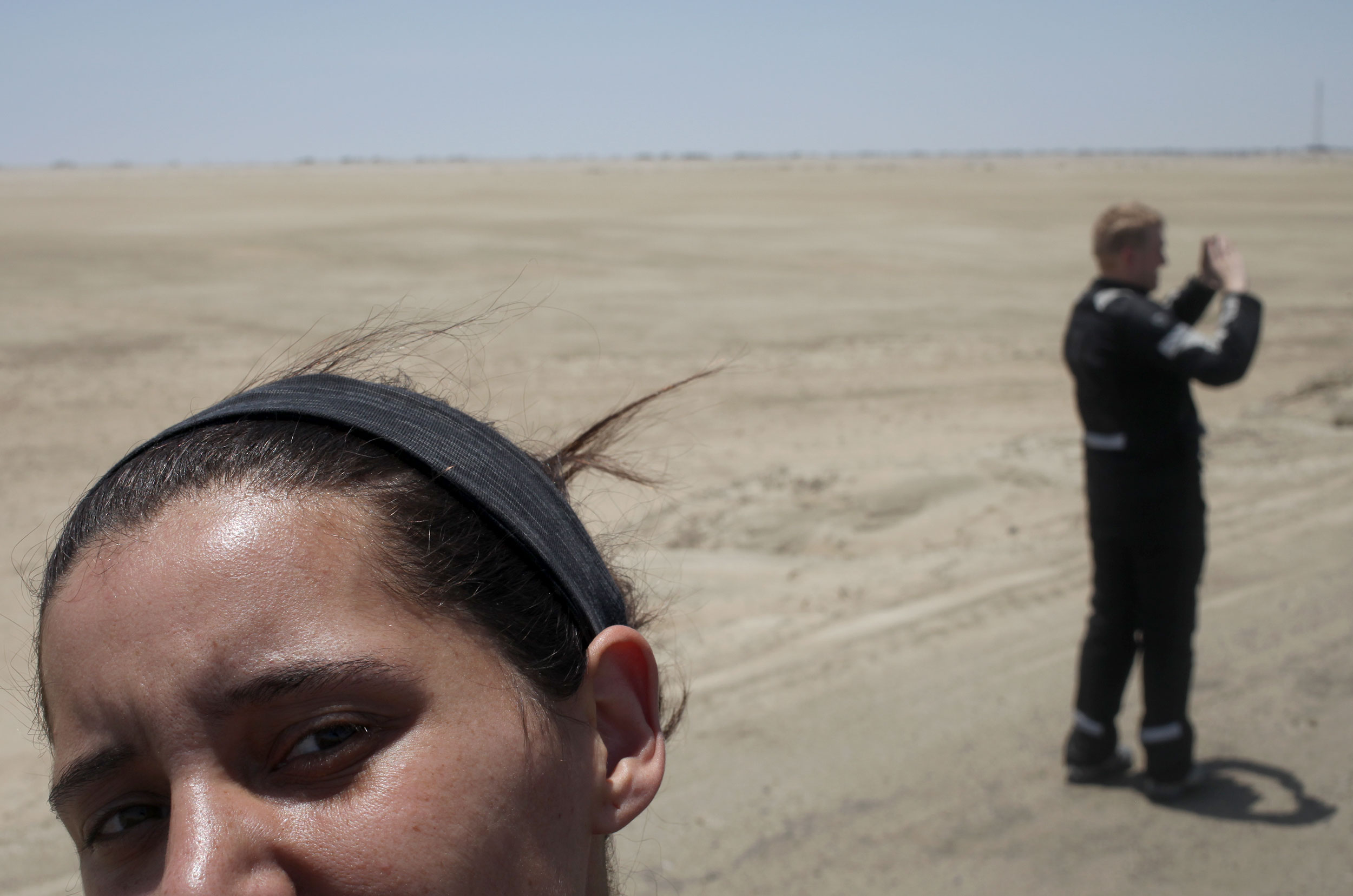
We stopped for a quick photo break 200 miles(isn) north of Lima. We were tired and dehydrated when we finally arrived although this desert is not actually that hot. Photo: Alex Washburn
What some people might not realize about this trip, or any trip on motorcycles, is that there are days where all you do is get up, and ride. It’s not a complaint, we have seen some of the best sights while on two wheels, but it is a reality I don’t think many people grasp. Riding into a town at dusk, looking for a hostel with parking (something you never worry about while backpacking), and only thinking about how much your ass hurts and that the overpowering, sometimes rancid, smell of your riding suit permeates every breath.
Get up the next morning, pack the bags, grab a bite and jump back on the bike for another full day. The dunes continue, going through small towns on a two lane road, dodging trucks and tuk-tuks. The sun is high in the sky, then low, then setting. The haze of evaporated water blends sky and earth and sand and road. A water color painting of a landscape that has no outstanding features. And we ride.
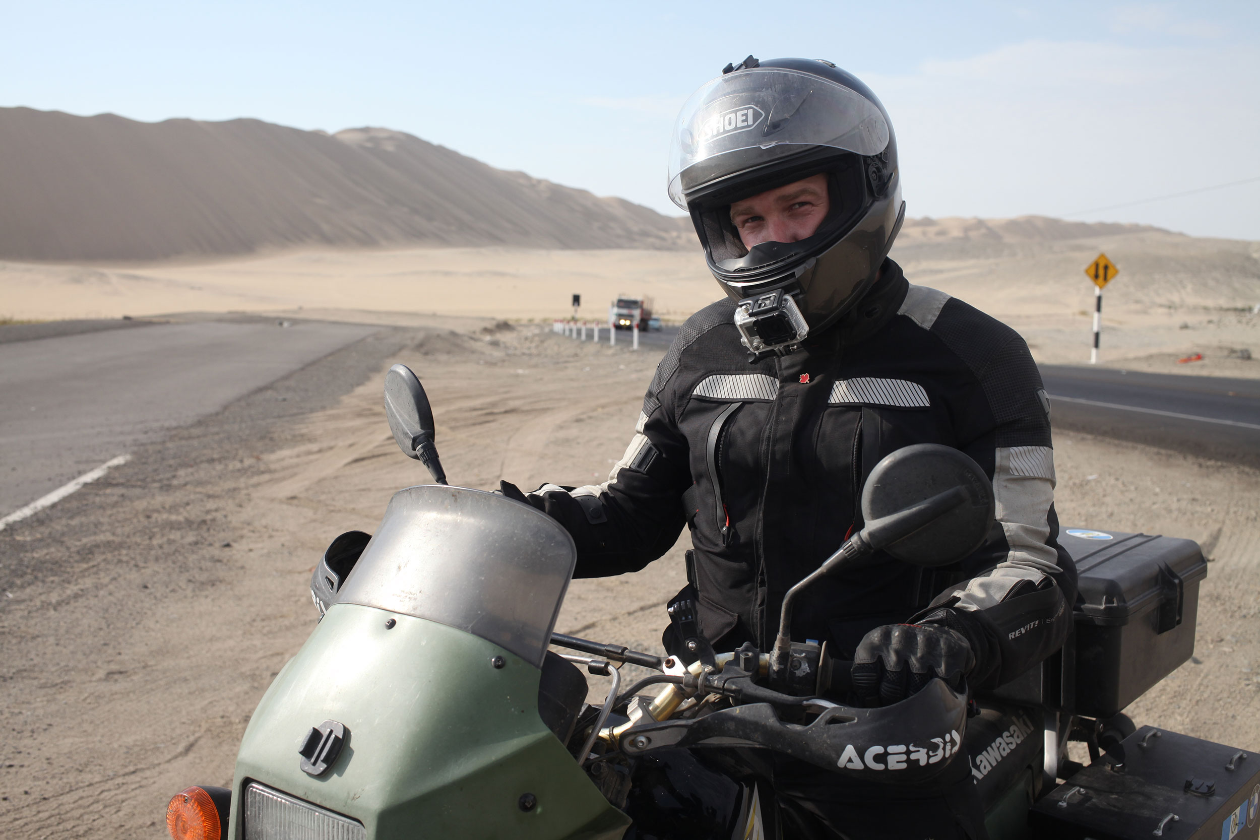
Nathaniel never takes photos of me so here is a selfie I shot with a 40mm. You’re welcome. Photo: Alex Washburn
Get up, pack, no breakfast, on the bikes. We make it to the ocean, dunes that lead right to the break. The towns become further apart. Stop when you can for food, for gas, for a break from the bike. Then more riding. The mirages stretche ahead, endless pools of nonexistent water, reminding you of the heat and the sand and the sun beating down. Sweat pools in your underwear, you can feel it every time you shift weight on the bike.
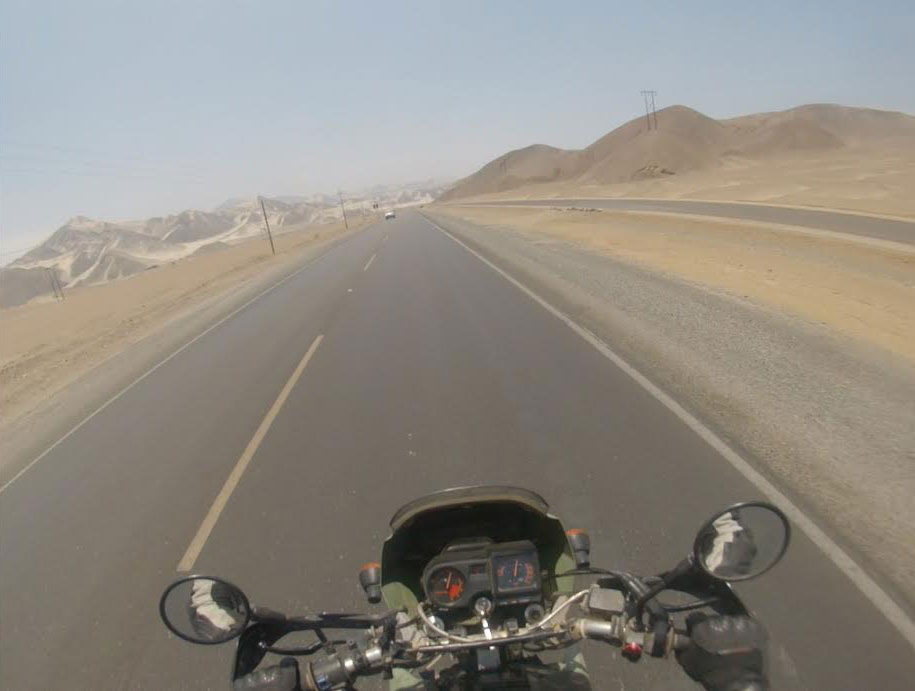
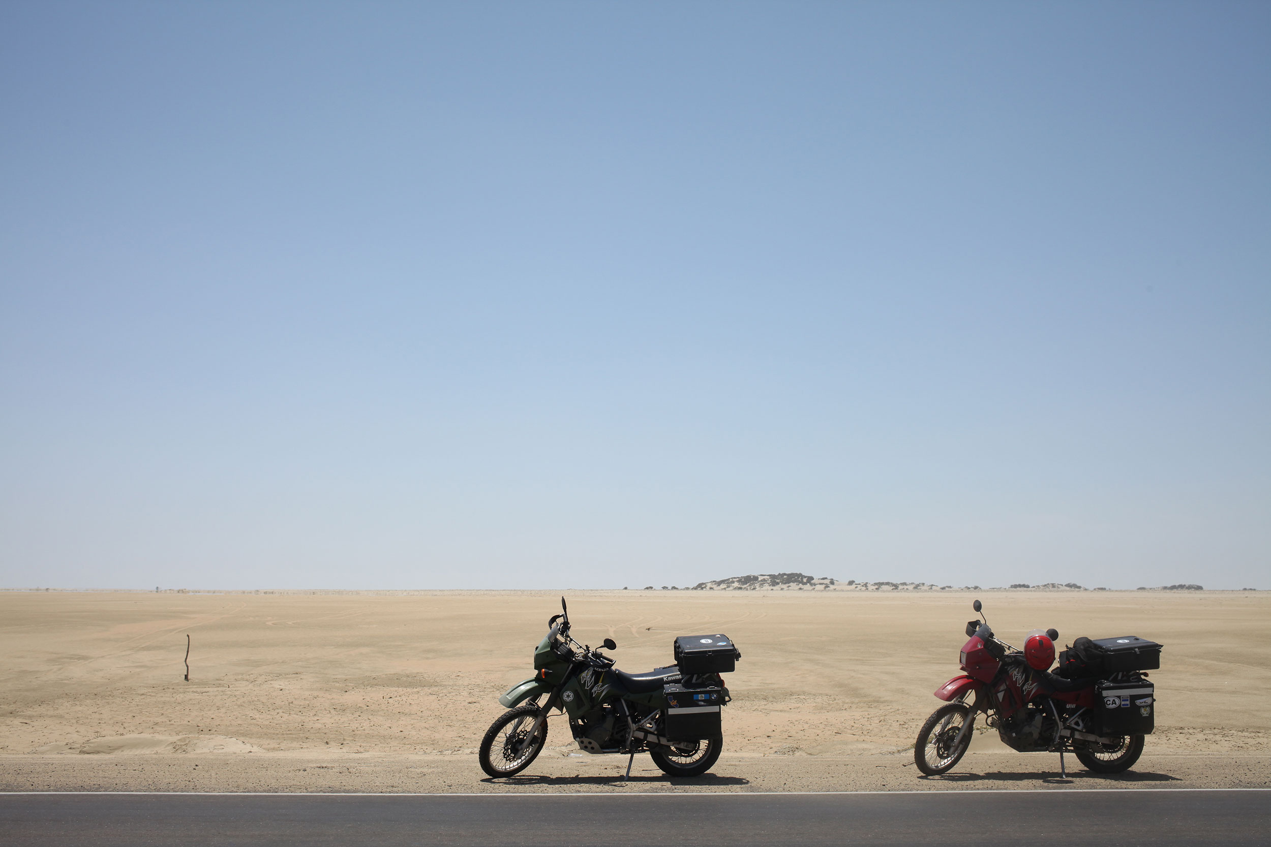
Even slight changes in scenery were exciting during our 700+ mile ride through the desert. Photo: Nathaniel Chaney
Its near the end of the third day that we hit a true stretch of freeway, not a two lane road, but an actual freeway and we twist the throttle and really open the bikes up. Ripping through the dunes, and the mountains of trash. What makes northern Peru look like a post-apocalyptic nightmare are the mounds of trash, which are usually on fire, that accompany the exit of every city.
Trash as far as the eye can see, with huts scattered throughout where people live and sift through the garbage. And then back into the desert of Mad Max the road warrior. The wind picks up, you tilt the bike, feel the sand sting that one spot your gloves and jacket have left unprotected. And the sun sets.
The final days ride brought us to Lima, our goal for the first leg of Peru.
Peruvians favorite part of the car is the horn, which they use instead of brakes or signals to inform others of the haphazard driving maneuvers they will perform that would churn the stomach of even the most talented of stunt drivers. Traffic be damned, Alex maneuvered us through the honks and sirens and shouts to our hostel, for a couple of days rest and some sight seeing before we get back on the bikes.
Casa Del Sombrero
Posted on February 5, 2014
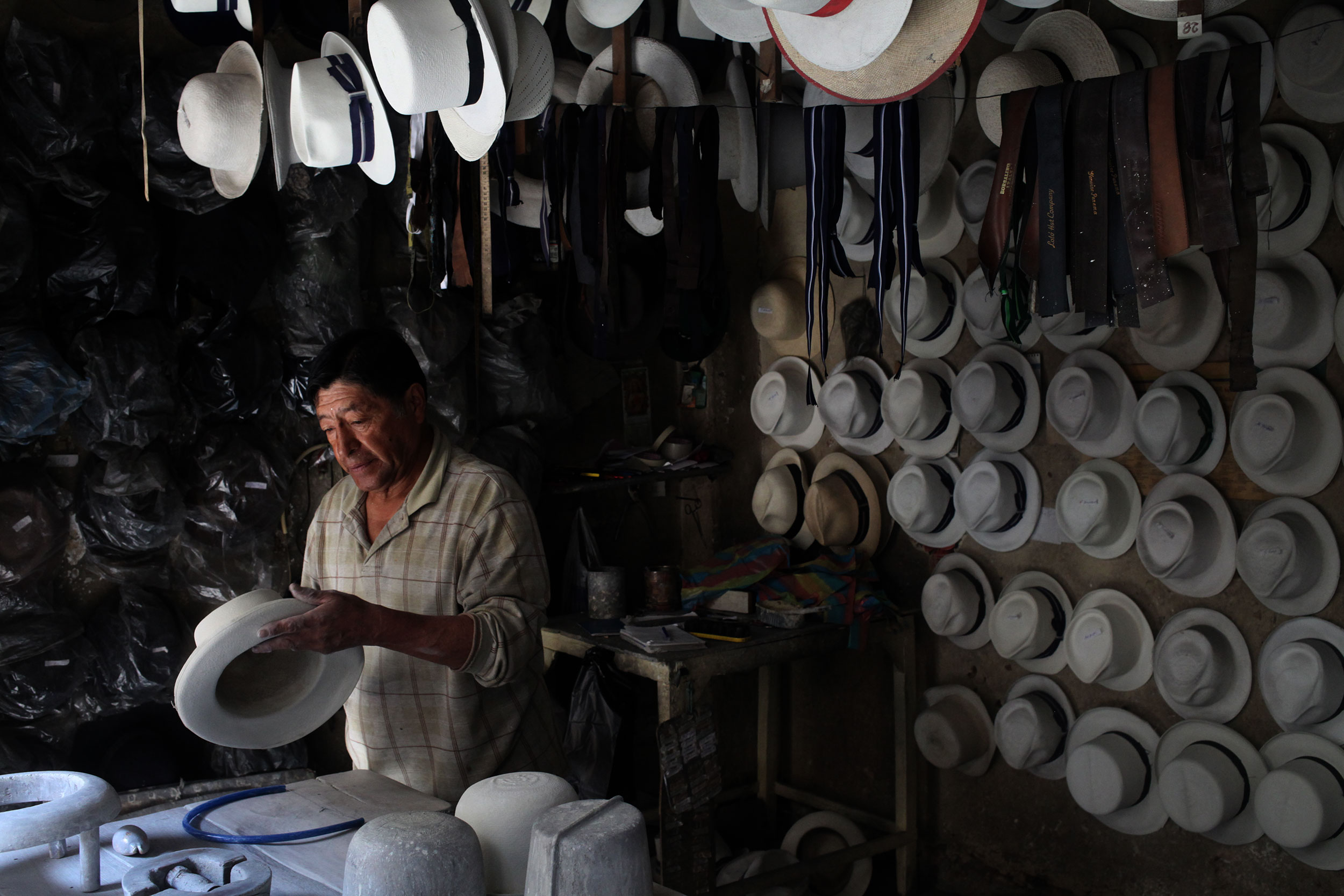
Casa Del Sombrero is a Cuencan institution. Photo: Alex Washburn
Approximately four years ago I had the great pleasure of meeting the great ‘Panama Hat’ maker Alberto Pulla.
You see- Panama hats are actually made in Ecuador and have a few other names (depending on their quality) such as Montecristi, or Montecristi Superfinos. They were the head covering of choice for many men who worked on the
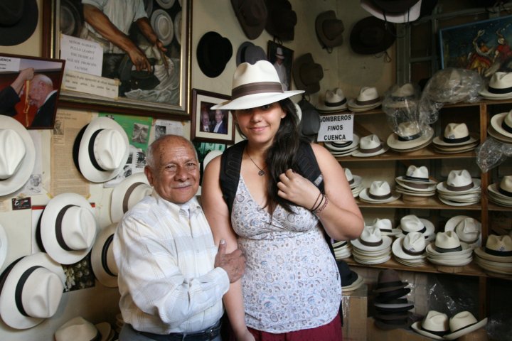
Alberto Pulla and I four years ago. Photo: Loni Rae
Alberto Pulla started making Panama Hats when he was just a child and the harsh chemicals they once used in the production of the hats cost him his voice, but not his smile or his kindness. By the time I met him he was a frail man that mouthed words, but primarily relied on sketching notes back and forth with tourists to communicate.
I wasn’t nearly as comfortable with my Spanish back then so I was absolutely terrified of Mr. Pulla even though the special old-worldness of his shop was not lost on me. As Nathaniel and I trickled our way south I told him about the shop and he decided he wanted to buy a hat from Mr. Pulla. Unfortunately when we were just a few days from Cuenca I learned online the famous hatter had passed away.
Sad but undeterred – we spent an extra day in Cuenca to vist Casa Del Sombrero (they are closed on the weekends) so that Nathaniel could get his hat. The shop hadn’t changed since I last saw it, it’s an absolute time capsule and I find that a special quality to be treasured in today’s world.

Nathaniel tries on hats to determine which one fits best as Juan-Carlos watches, answers questions, and helps with the process. Photo: Alex Washburn
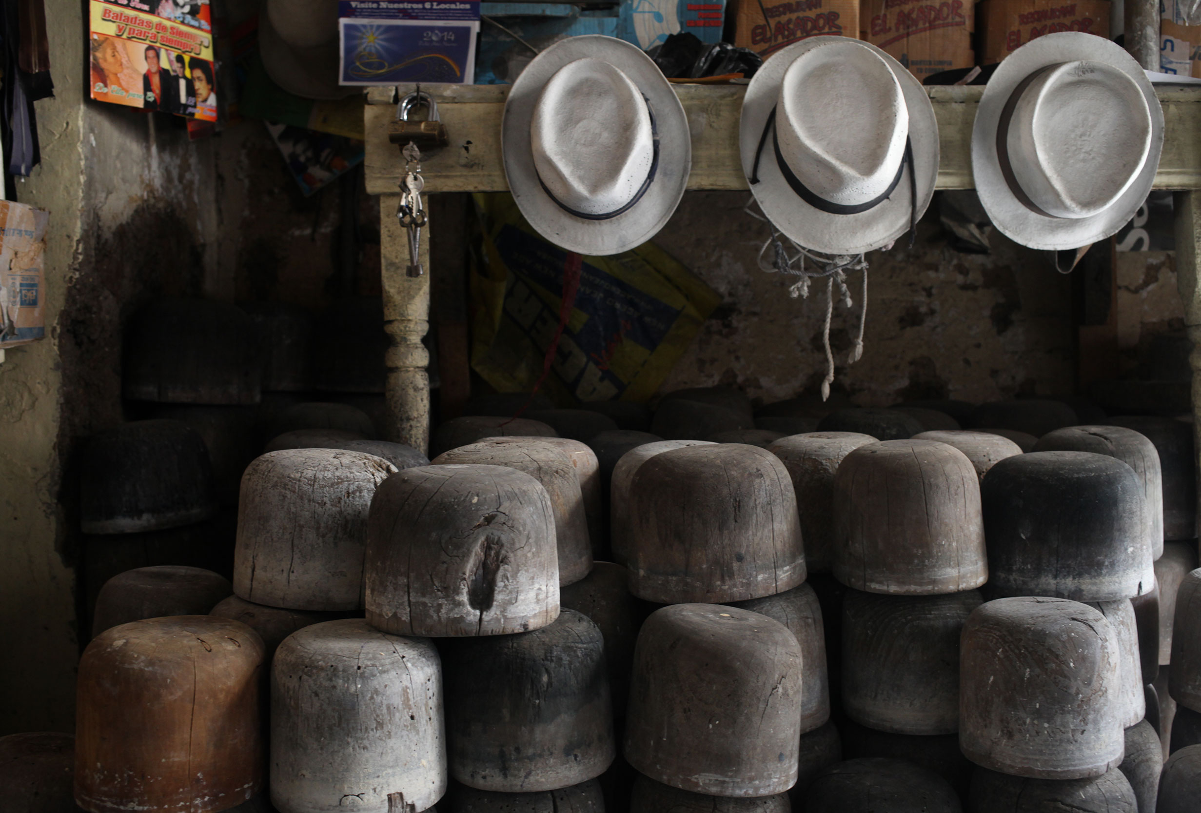
Tools of the trade – pretty much unchanged for over a hundred years. Photo: Alex Washburn
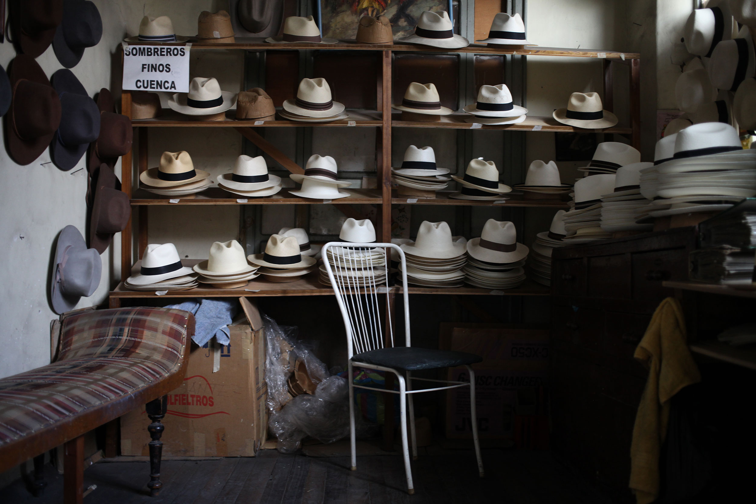
Although Alberto Pulla has passed on, his family continues running Casa Del Sombrero. Photo: Alex Washburn
The swing…
Posted on February 1, 2014
…at the end of the world.
On a mountain, above a sleepy town nestled in the mist of the Andes laying in the shadow of a volcano, waits a man. He listens to wind, feels the restless earth, and is every watchful of the volcano, a constant guardian of the city and a very special swing.
Dangling from La Casa Del Arbol, a house in the only tree on the mountaintop, is the swing at the end of the world. Travelers have been known to come, from far and wide, to swing over the edge and see what their destiny holds. Whether it is the thin mountain air or the rush of going over the edge, many have left the mountain changed.
Carlos, the volcano watcher, never swings. He sweeps the grounds, herds his two cows, has family visit once a week, but he never swings. He smiles at the weary travelers, as they appear out of the mist and then dissolve once more into the quiet countryside, but he never swings.
The travelers donate what little they have to help maintain the swing of their dreams, that others may come, as they have, to see into their futures. Carlos replaces nails, tightens loose rope, and checks the foundations of La Casa Del Arbol, but he never swings.
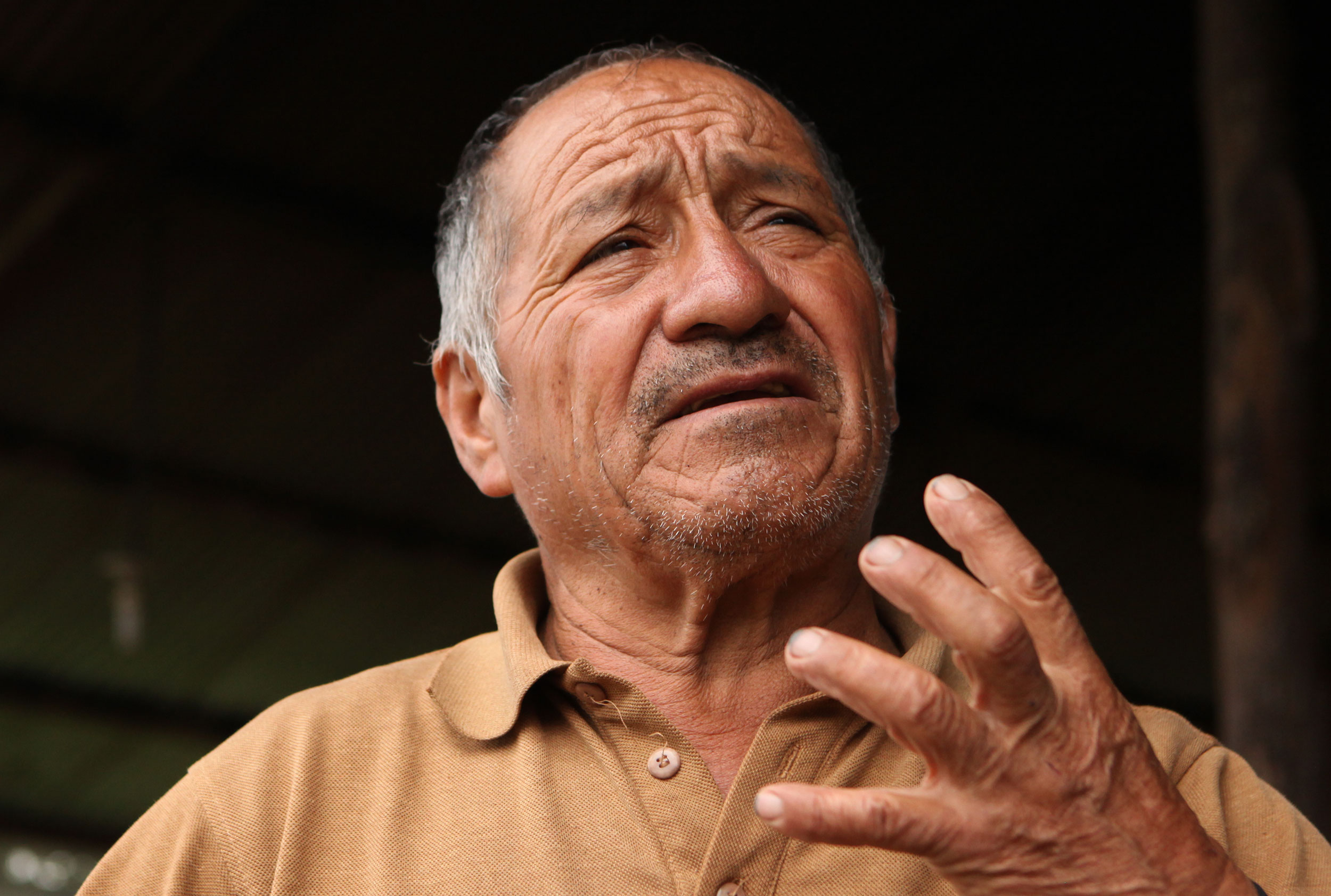
Carlos talks about his life living on the mountain watching the volcano above Baños Ecuador. His family visits him once a week (on sundays) but other than that his everyday company are his two cats, two cows and the tourists that float through. Photo: Alex Washburn
Occasionally he will talk to one of the travelers. He tells of the volcano and of the house, but rarely of the swing. To those he likes, he invites them to leave a message in his journal, for the lonely hours he spends on the mountain, watching the volcano, but he never swings.
For those who will come and those that have gone, their paths were their own. But for Carlos, he is the watcher of the volcano and the guardian of the swing at the end of the world. That is all he needs to know. So let others come and swing, he is fine smiling and watching and guarding.
(The above is just a fictional interpretation of Casa Del Arbol, feelings that I had while we were there. Carlos is real, he is the old man that watches the volcano and signals others if there is activity. He does have a book he invites some to write a message in for the long hours on the mountain and his family does only come once a week to visit him. He is the guardian of the swing at the end of the world. –Nathaniel)
Chasing Asphalt to Ecuador
Posted on January 30, 2014
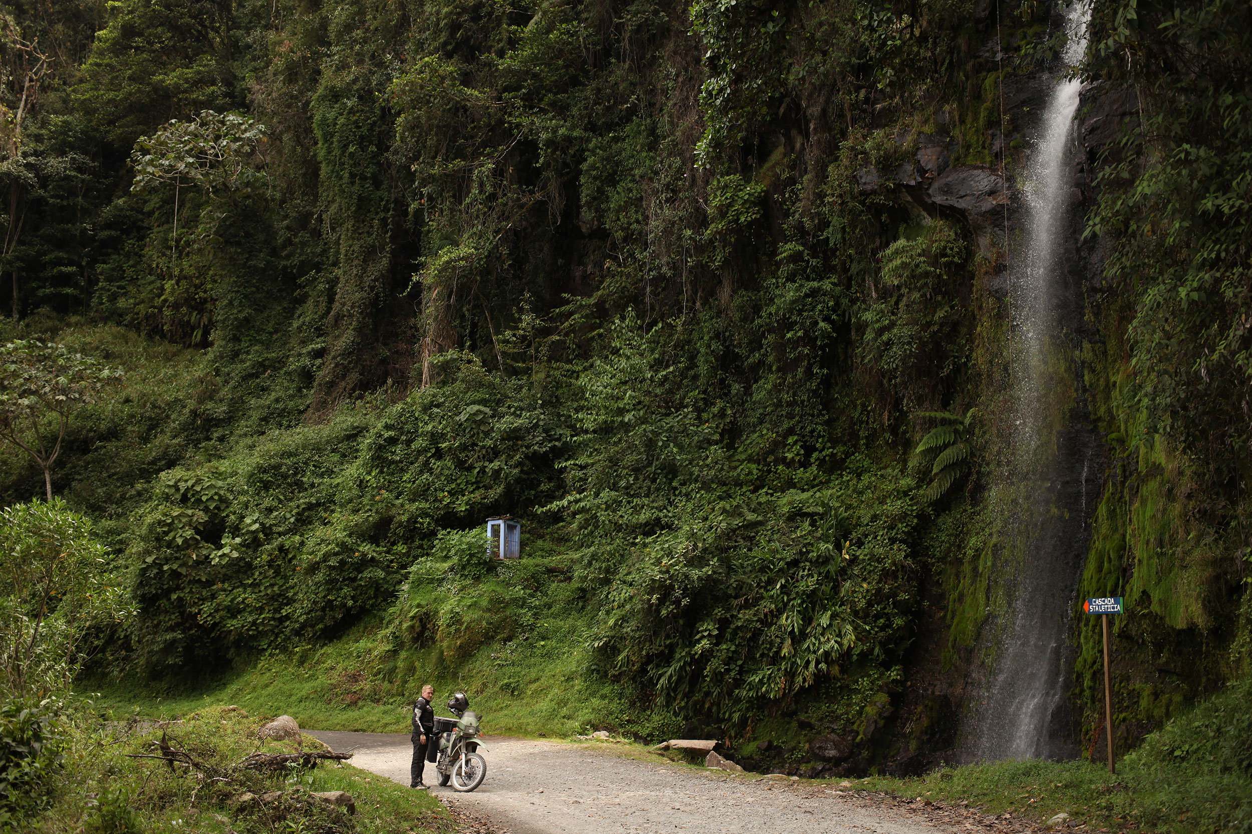
Between La Plata and Popayan Colombia we found the Staleticia waterfall. We pulled over without discussing it and just stopped to appreciate it for a minute. Photo: Alex Washburn
After Bogota it was like Willie Nelson said “on the road again”, the miles just keep coming and we are going with them. From Bogota we were headed for Tatacoa (the desert we thought we were going to with the KLR riders), but ended up passing on through (a longer story of how we got lost and would have had to cross a river on a dingy is involved, but we wont go there) and kept on the road. It went Bogota, Espinal, La Plata, Popayan, Pasto, 500+ miles of riding to get to the border and into Ecuador.
The only glitch was in looking at Google maps and not realizing that even if a road is listed as a highway it might just in fact be a dirt, rock, pothole road that stretches on for 75 miles. That was the day of riding when we went from La Plata to Popayan, at the beginning of which Alex famously said:
“I think it will be all paved today.”
The scenery of Colombia has been just amazing, but it is hard to focus on when your going ten miles an hour and getting bounced all over the place. Imagine riding on a road that is going through middle earth (J.R.R. Token’s Middle Earth), the scenery is amazing, but I don’t think those hobbits put a lot of effort into smooth roads for their wagons. The next day was an exhilarating ride through the Andes to Pasto, at some points literally riding on the side of mountains and dodging trucks trying to get to a warm bed and a hot meal (because a warm shower is a little to much to hope for).
The next morning it was up early and off to the border, with a stop on the way at Las Lajas, where there is a cathedral built into the side of a mountain over a river. I had seen pictures before we got there, however the site impresses regardless the way few sites really do compared to photos.
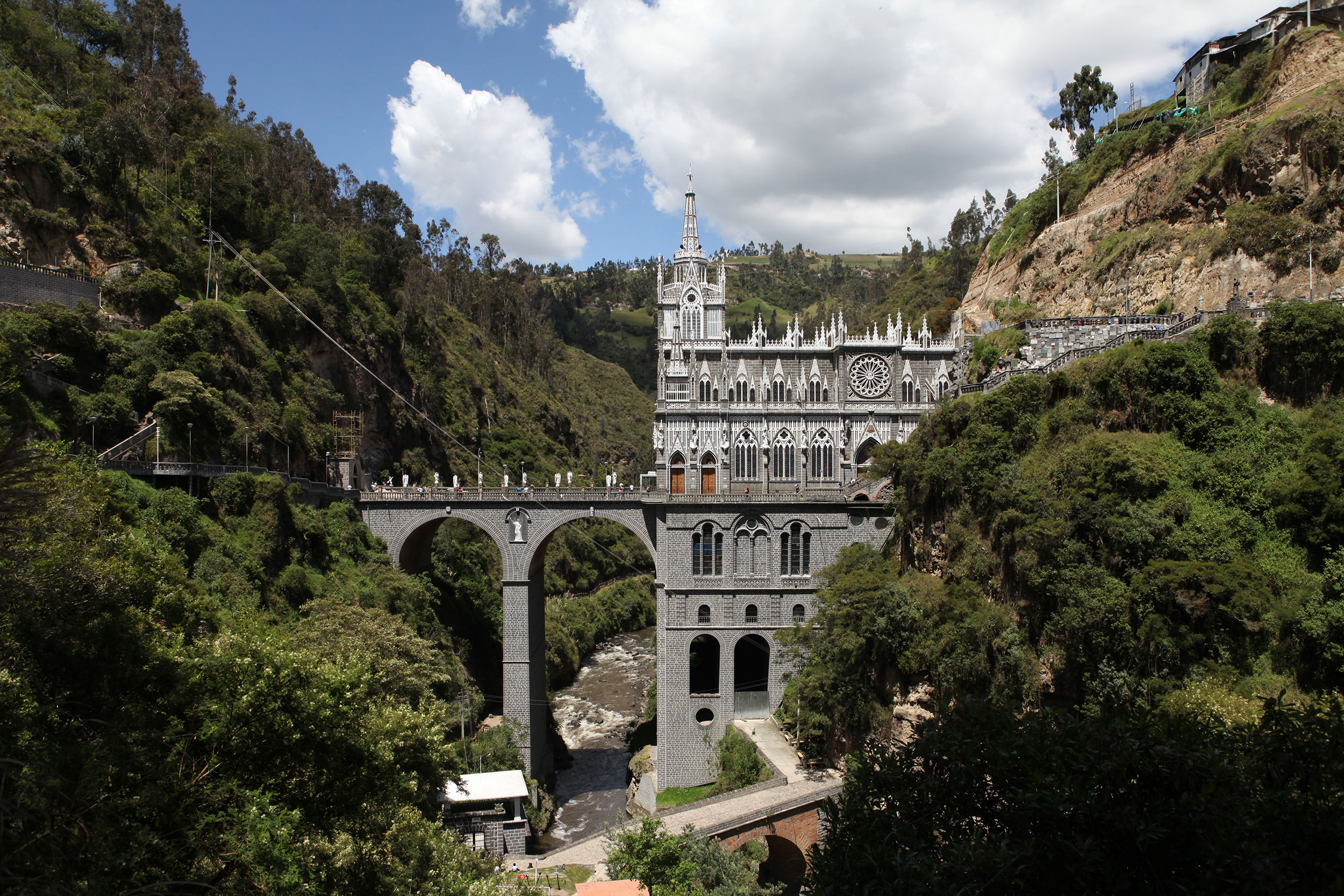
The Santuaria de Las Lajas is an incredible place to visit… When we arrived I couldn’t help thinking ‘Colombia just HAD to wow us one more time.’ Photo: Alex Washburn
As we pulled up to the parking lot, I saw another KLR with a trailer and the driver approached me before I even made it into a slot. The pilot is a Norwegian named Jørgen who is planning to ride to the tip of South America by the end of the year. He bought the KLR in Colombia, it had been in the country way beyond the allowed time and so he was heading to the border as well, with a plan to just drive across and then walk back and get a stamp before heading to Ecuador (the plan worked by the way).
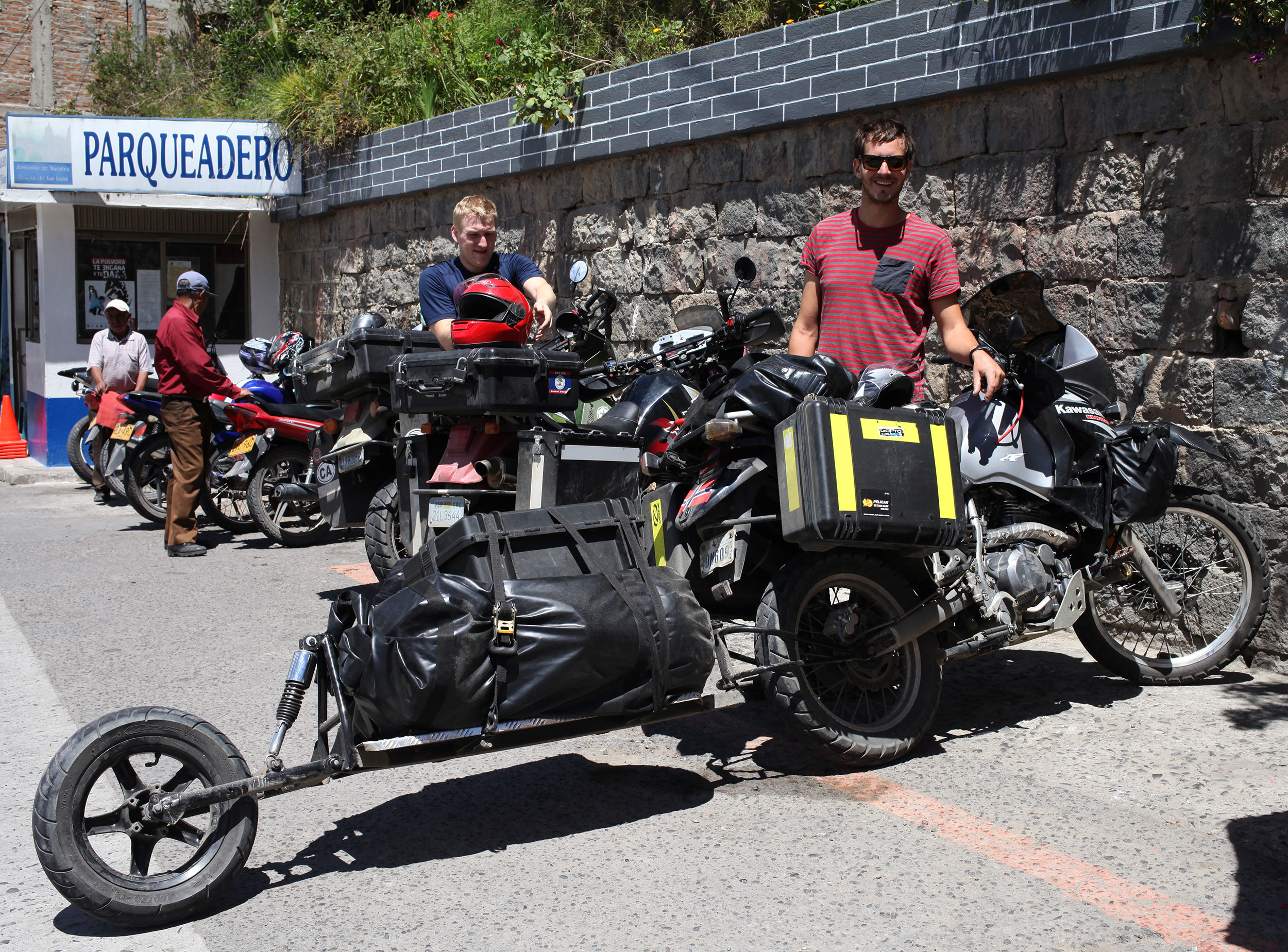
Jørgen poses with his KLR650 and the trailer he had custom made (for less than $100) before we leave the Sanctuario de Las Lajas to go have guinea pig for lunch. Photo: Alex Washburn
After this is was time for lunch (cuy, which is a large guinea pig) and then off to another border crossing and our 11th country of the trip!
We made it to a little town called Otavalo, which was rumored to have a massive market on Saturdays. As we cruised into town it was apparent the rumors were true, as almost every street in the centro had stalls selling everything from bracelets and textiles, to food and spices. We high-tailed it to a hostel and then headed out to the markets to see what we could find.
The market covers most of the downtown, with the main square having many stalls that are stationary and then tons of tarps thrown up to create many nomad stalls. We spent the majority of the day watching all the gringos shopping and haggling with the vendors. While the market does cover a tremendous amount of space, most of the wears start to blur together without a tremendous amount of variety if you aren’t interested in textiles of some sort.


In the evening we met up with Jørgen who had made it to Otavalo and ended up having a meal of delicious street food: tamales, empanads, meat kebabs, and a hot strawberry drink to help fight off the chill at such a high altitude. A couple hours of good conversation with a fellow traveler before it was time to hit the sack for another riding day.

We pose on each side of the equator line at the La Mitad Del Mundo monument just outside of Quito. Photo: Alex Washburn
What really struck Alex and I was that we had ridden from California to the center of the world. It marked a milestone in the trip and we were happy that we had done it together (without killing each other…yet). There are still miles to go and adventures to be had, but for the rest of the day we basked in accomplishment, now officially in the southern hemisphere.
