Where the Autopista Ends
Two motorcycle bloggers in the San Francisco Bay Area.
Happy 10,000 miles AutopistaEnd
Posted on February 21, 2014
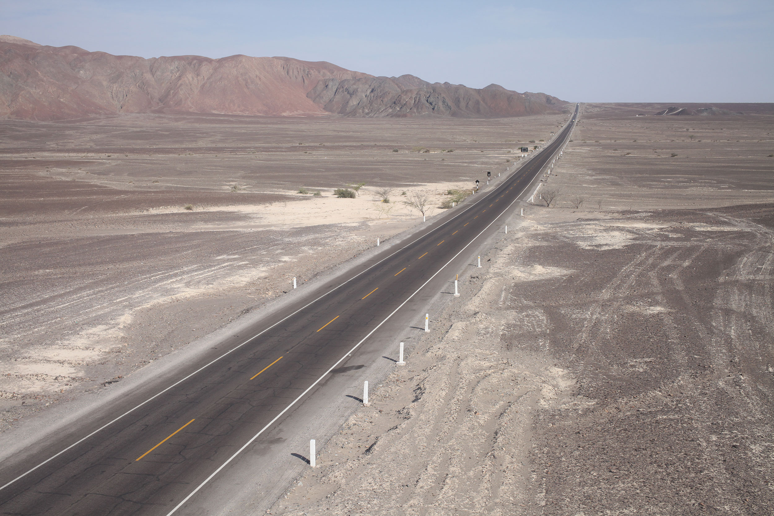
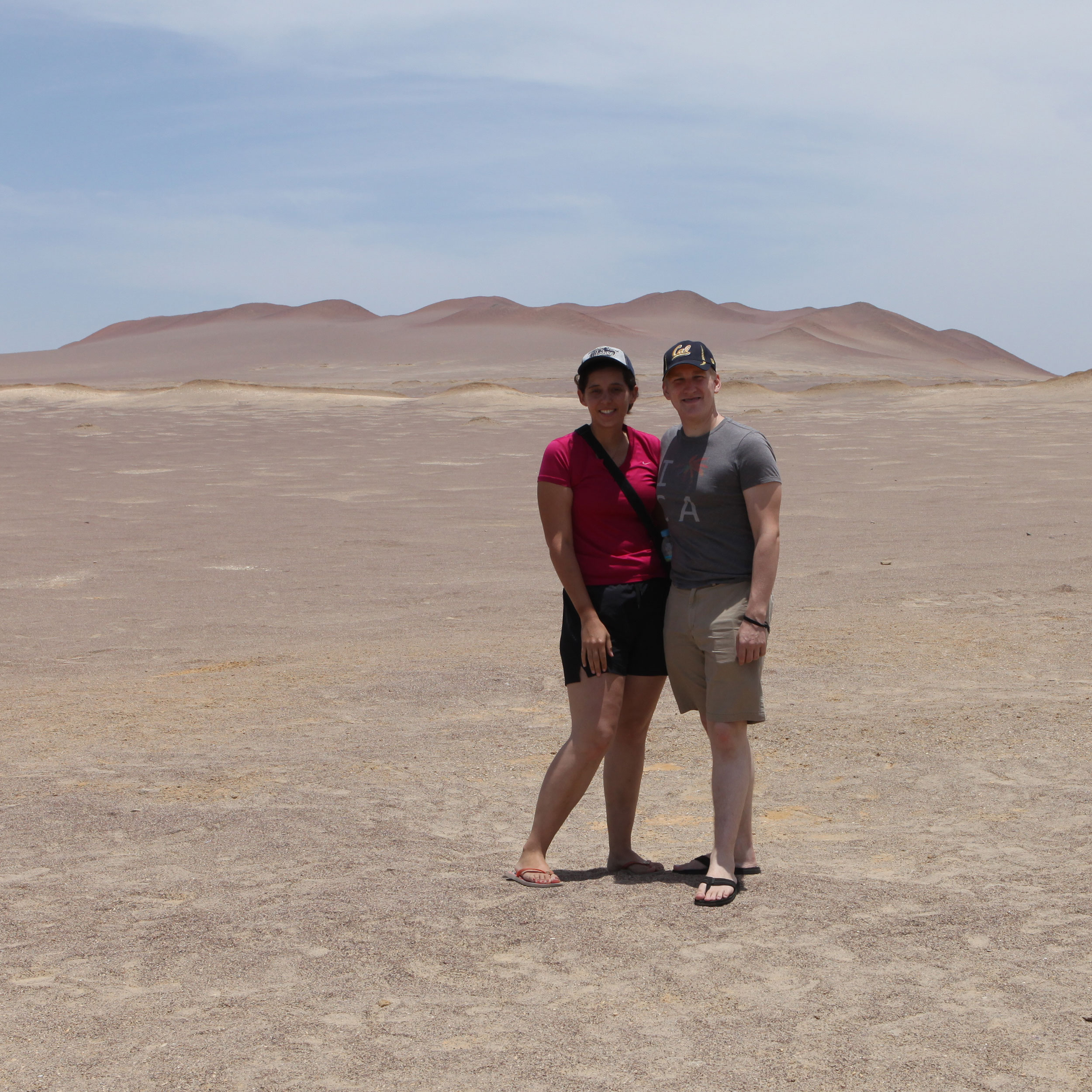
The Peruvian coastal desert is a formidable beast. After almost a week it had beat us into a lethargic submission. This photo was taken just outside of Nasca. Photo: Alex Washburn
It is true, right outside of Nazca (there are signs that say Nasca when you enter town so I am confused on how to spell this city) we hit the 10,000 mile mark! From Alex’s house in California to Nazca has been a crazy ride, and we have cherished every mile, though many haven’t been easy.
12 countries, 68 cities, 3 pairs of underwear (for Nathaniel anyway). We are currently in Cusco, which is very close to being on the same latitude with Cuiabá, Brazil, considered the geographic center of South America. What this means is we are about halfway through with our travels in South America and we have a little over a month before we should be rolling into Ushuaia.
Moving on from the nostalgia of the 10,000 mile mark, the ride from Pisco to Nazca was more of the same desert and sand we had been riding in since getting to Peru. On the outskirts of Nazca is a giant steel tower where you can view two of the Nazca Lines (‘the tree’ and ‘the hands’), though you don’t really get the kind of view you do from an airplane. We stopped on our way into town and paid the equivalent of $0.71 to climb to the top of the observation tower.
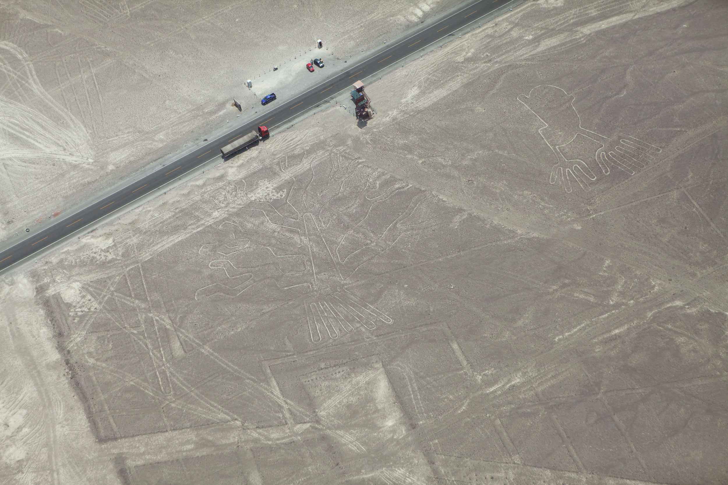
Here is an aerial view of the observation tower we stopped at on the way into Nasca. The tree (left) and hands (right) are clearly visible – check out the semi truck on the highway for scale! Photo: Alex Washburn
After reading several reviews of how to book tours by air of the Nazca Lines, we got up early the next morning and went to the airport to commandeer an airplane. There are several vendors at the airport, and as we arrived the security guard told us to make sure we shopped around, although they all seemed to offer about the same rates.
Online they listed the price at being around $90, though the range seems to vary from $80-$100. We were quoted $75, and decided to go with Aeroparacas for a 35-minute flight. As noted though, they are all really the same, and I would try to play them against each other if you can’t get a better price. Frommer’s suggests the best time to hike the Inca Trail (Machu Picchu) is June to September, so during these months it might be harder to negotiate a good deal.


The other suggestion, which was reiterated by our pilots: the morning is the best time to fly as the winds are at their lowest. Neither Alex nor I got airsick, though we both took motion sickness pills before we went up (rather be safe than sorry). The tour is quick, but you get excellent views of the lines (note there was going to be a GoPro video, but the camera couldn’t distinguish between the lines and the sand, very disappointing).
If you are near Nazca it is definitely worth a trip to see the lines, they are quit amazing. Alex and I both commented that we thought they were going to be bigger, as many aren’t as big as the most famous, ‘the hummingbird’. Overall it was great experiencing, something that I learned about in middle school and never thought I would see in real life.
Unfortunately for most travelers, if it wasn’t for the lines themselves no one would bother to go to Nazca (no offense to the people that live there, I myself am from a tourist town) as it is in the middle of desert that is transitioning into mountain terrain. The town has created other tourist attractions (sand boarding and tours of Inca sites), but the real draw for this tiny town are the lines.
(Always make sure to click the settings wheel on the lower-hand side of the video, to get the best quality 1080p viewing)
After our morning flight and some late breakfast, Alex and I were exhausted. I don’t know if it was being in the sun the last couple of days, or simply the wear of travel, but we both crashed for most of the rest of the day. It must have been what our bodies needed, because we have been on a roll ever since.
From Nazca it was a race to get to Cusco, up into the Andes Mountains. Peru finally showed us some of the famed countryside, Swiss style mountains and rolling hills that look like they could house something like Machu Picchu. It was great to finally get out of the desert, and into some lush terrain.
We thought we could get to Cusco in two days, but riding through mountains make for slow going. Between Nazca (1,710 ft) and Puquio (10,545 ft) we climbed close to 9,000 ft in elevation. After inquiring with a gas attendant in Puquio as to how far the next town was, we decided to stay the night and enjoy the ride the next day instead of pushing it to the next town.
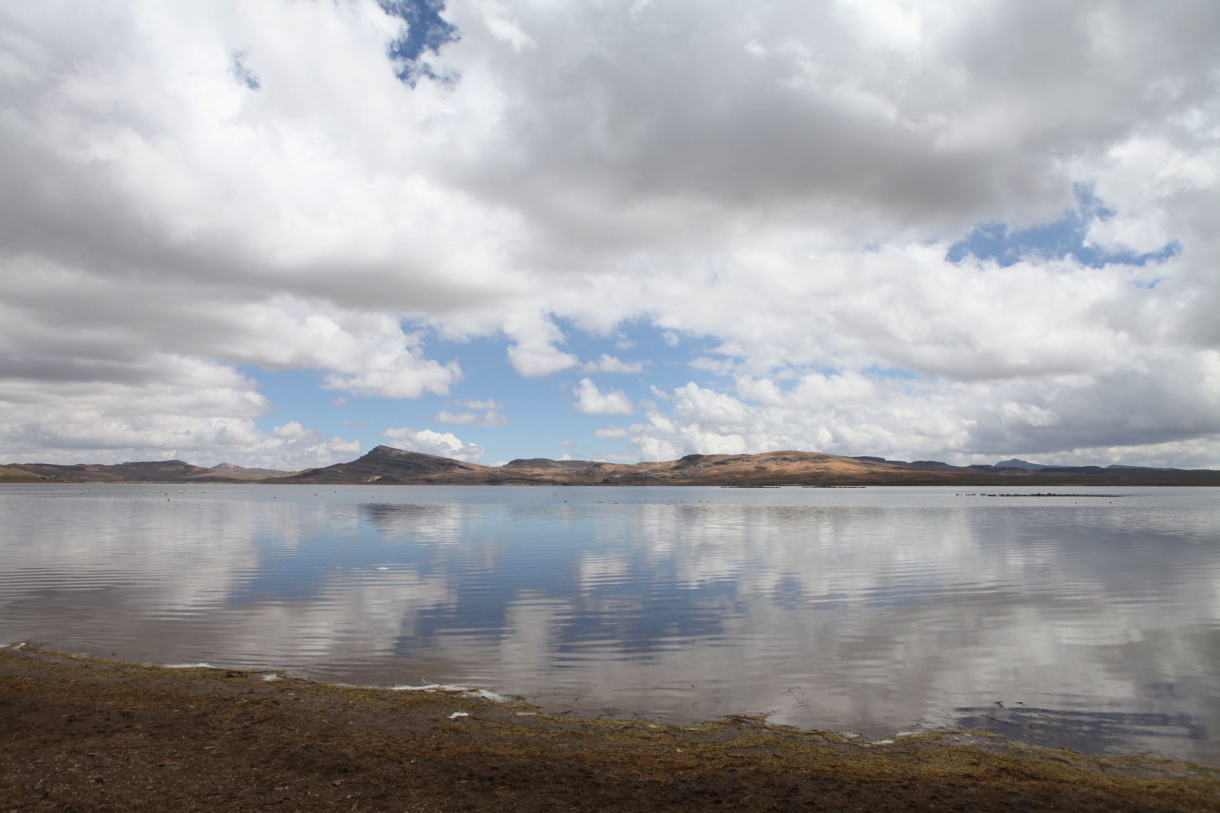
I saw wild flamingos in this lake on the way to Cusco so we stopped to check it out. Sadly, they floated away from us when I started walking towards the water but it was beautiful nonetheless. Photo: Alex Washburn
I suggest to any riders doing this section of Peru to do the same if they have time in their schedules because the ride from Puquio to Abancay is some of the best scenery and one of the top five rides of the trip! From the moment you leave Puquio you climb into the mountains and are treated to lakes with wild flamingos, herds of roaming llamas, and endless scenic valleys.
Alex and I took most of the day to ride this stretch of road, stopping often to gawk at llamas or stare at the scenery. I commented to Alex that if people ask me what was the best part of the trip when I get back, that days of riding like this were by far the most enjoyable. You don’t know when you wake up that day what your in-store for and it makes the experience all the more sweet.


(In the next day we will upload another blog to detail some of the missteps that have occurred since we got to Cusco, but thought we would end on the high note of great riding)
A quest for penguins
Posted on February 16, 2014
One of our fellow tourists (from Hong Kong) at Reserva Nacional de Paracas, just outside of Pisco Peru. Photo: Alex Washburn
Lima is more than double the square mileage of Los Angeles and you feel it as you wage war navigating it. Most of the countries thus far have had more aggressive driving than in the US, but they still respect motorcyclists as part of the traffic flow. Not the case in Peru, and there are noticeably less motorcycles in this country than the majority of the rest of Latin America, which may be partially to blame for drivers lack of concern over motorcycles. This goes for most of Peru, but is exceptionally bad in Lime (talking with a Brazilian biker today confirmed he also thinks Peru treats bikers poorly).
This is an awkward couple photo. Enjoy! Photo: Our fellow traveler
Further down the road is the Monasterio de San Francisco, known for its humongous catacombs, which has some 70,000 human remains that weren’t discovered until 1943. Many of the bones were placed in circle pits, that were built to absorb earthquake shock, in geometric patterns with skulls creating circular patterns. What Alex and I found just as fascinating was the Peruvian Last Supper by Marco Zapata, which is painted on one of the walls in the cathedral. Google it, and you will notice that a lot of the food depicted are traditional Peruvian dishes, as well as, there being more people than just the 12 disciples.
Other than a couple trips around the city, Alex and I had business to take care of getting the bikes some much needed service, new oil filters, spark plugs, chains cleaned, new brake pads. On top of this I was dealing with some stomach
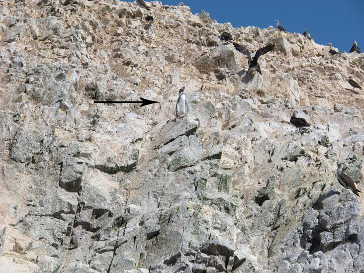
Nathaniel as a general rule does not like animals but he loves penguins. This was one of the little guys we spotted on the tour! Photo: Nathaniel Chaney
On a note of point, I did learn in Lima that Peru has penguins! They are the warm weather kind, and are in a large bird sanctuary that was on our was to Nazca.
Stomach feeling better, we jumped on our nicely cleaned bikes and roared off south, after spending an hour in traffic getting out of Lima. A short ride to Pisco, where we go ready to to see the sites the next day.
The tour of the marine and bird sanctuary was decent, but Alex and I really only cared about seeing the penguins, and we ended up getting to see two, which made it worth it. Also on the tour you get a great sea view of Paracas Candelabra, a geoglyph carved into the northern face of the Paracas Peninsula. It was carved using the same techniques as the Nazca lines, and is quit impressive when you see it.
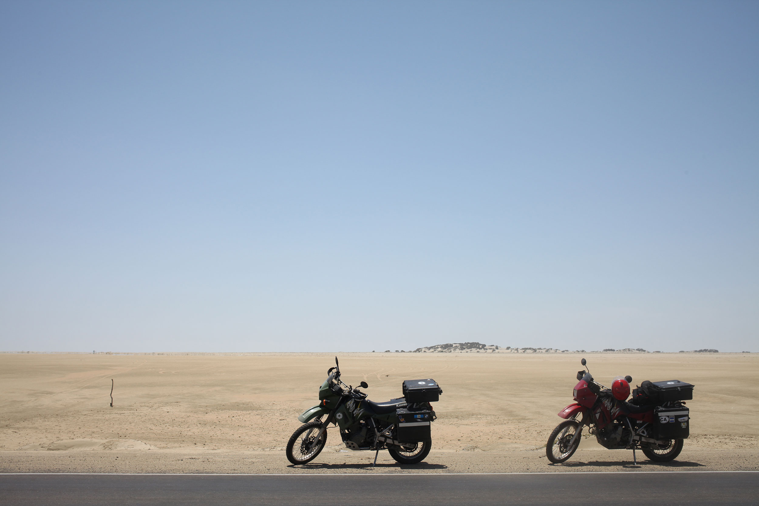
More desert, dunes, and riding as Peru is nothing if not consistent in the parts we have rode through thus far. It was another short ride down to Nazca, and here we find ourselves as we get ready for a plane ride over the famous lines.
More to come.


(Alex says she hates all of her Lima photos which is why we are not using any in this post.)
Driving in the Post-Apocalypse
Posted on February 9, 2014
One of our last views of Ecuador. Photo: Alex Washburn
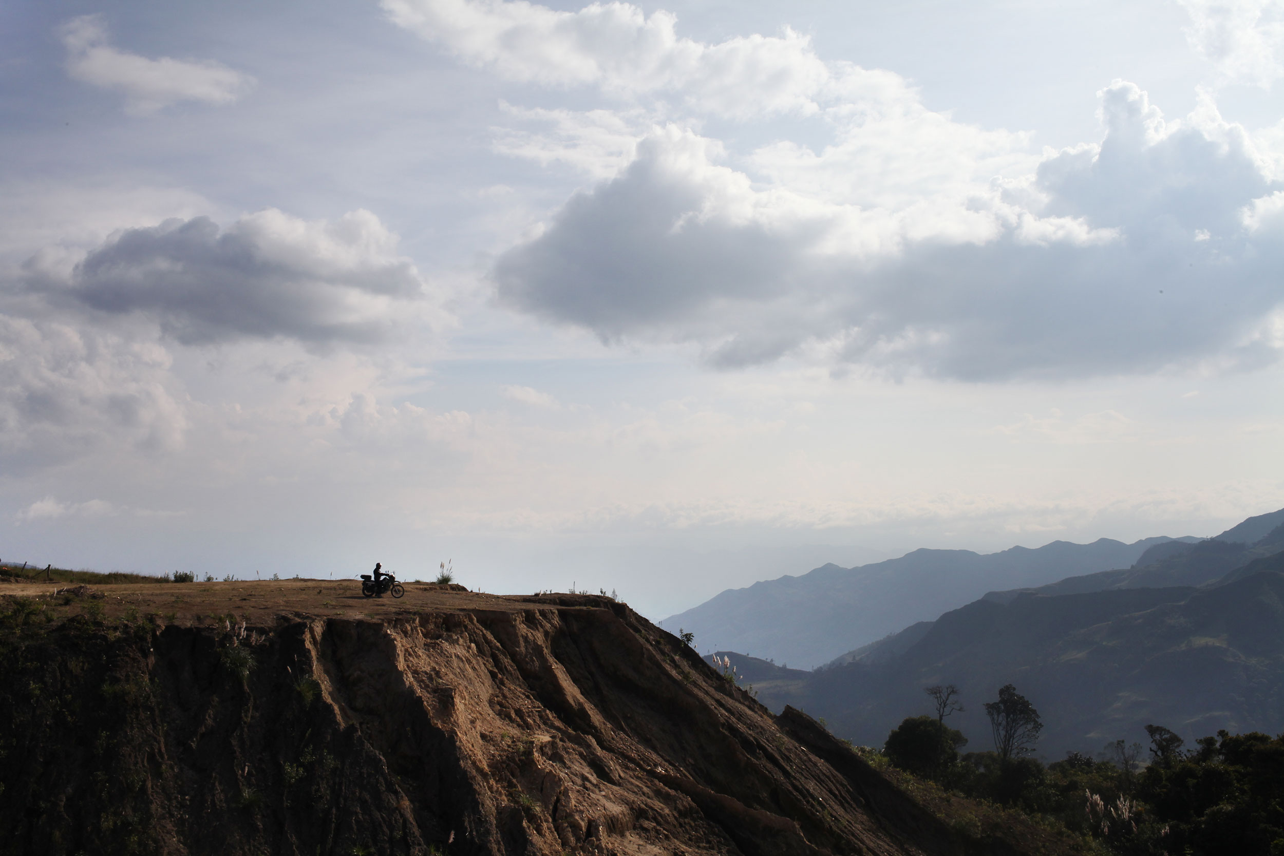
After our restful time in Cuenca, it was time to pack the bags and hit the road. We thought we could make it out of Ecuador in one day, but seeing as half of the country has the Andes mountain range running through it, you can’t make it anywhere very quickly.
In Mexico we weren’t happy with anything less than a 200 mile day, but when hairpins and s-curves, climbing then descending then climbing again, and dodging trucks (and stray dogs) is the norm you’re happy with a 100 miles. However, the day before our last day in Ecuador we saw some of the best scenery in the whole country, rolling green mountains, and just enough curves to have fun on without slowing you down.
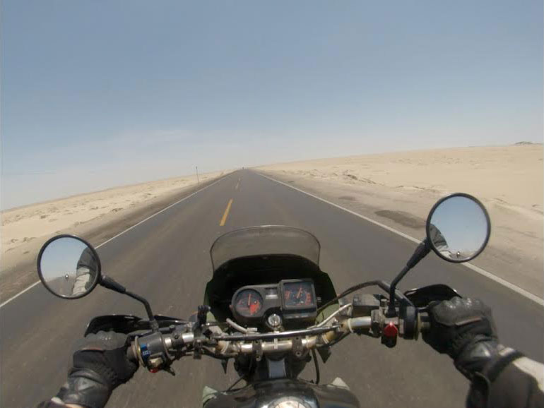
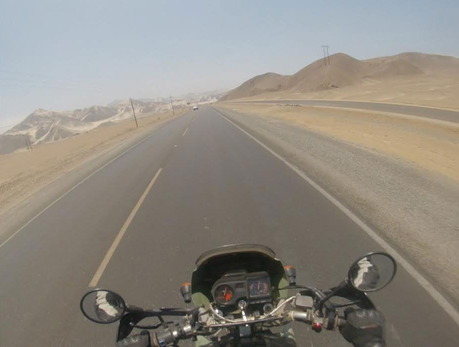
Northern Peru greets you with over 700 miles of this. Photo: Nathaniel Chaney
Research is a must before every border crossing! Even if it is just to see pictures of where the buildings are (many crossing in Central America have the buildings in illogical places where they must be hunted out) and to know how much you might have to pay for insurance. In looking at the Ecuador-Peru border there seemed to be unity on the inter-webs as to its ease.
Leaving early and never knowing what to expect we headed to the border and in less than an hour and a half we were processed out of Ecuador and into Peru. This was the best border crossing of the whole trip, bar none. The Peruvian Aduana (customs) employees were friendly and helpful, two qualities you don’t find in many border officials, and a first of the trip, they even made copies for us of the paperwork they required!
Many of the countries that we have visited have shocked me in how different they are then I had imagined them. For instance, I always thought that Colombia was just one giant jungle. And don’t get me wrong, there is jungle there, but no country is one ecosystem, and the landscape of Colombia is one of the most diverse we have seen. With that said, northern Peru was exactly how I imagined it.
The coastal desert region of Peru covers roughly 73,000 square miles of land and reaches inland between 12 and 62 miles. It is known as the Sechura desert in the north. Photo: Alex Washburn
Ecuador is green, lush, and for a third world country, particularly trash free (Alex informed me later that there were anti-littering signs posted everywhere along the road). Northern Peru could not be any different, and was the most dramatic shift in environment we have experienced. The landscape is dry, arid desert spotted with a few towns. As you continue, the desert only intensifies into dunes that remind one of Tunisia.
We filled up with gas after the border, using the last of our cash, and continued on, hoping to hit an ATM at the first real town. Tambo Grande was the first larger town (i.e. not a cluster of huts along the road) that we stumbled upon and we went in search of an ATM. After driving through the whole town we stopped and Alex asked a passerby where we might find a cash machine. His response was that there wasn’t one in the entire town.
We got to a point on our first day rolling through the Sechura desert where we just slowed to a stop in awe of the nothingness surrounding us. Photo: Alex Washburn
Onward it was. Continuing through large swaths of dry desert and the occasional grouping of houses, that are more what people at home would think of as huts, on the sides of the freeway. We got to Piura (the first major town on the map) and here we struck pay dirt at a mall that had a line of ATMs from every major international bank. We decided to call it quits for the day and thankfully we did, because early the next morning we found out how long it was to the next town.
What started as brown dry desert reminiscent of Baja, California, gradually turned into dunes as we got further from Piura. The luck of that day was that we filled up before we left Piura, because once we were in the desert it was 120 miles to the next town. As we entered the Zonas de Dunas, the winds picked up and it was hours of riding with the bikes tilted at an angle, reflected in the small brush on the side of the road that had grown blown in one direction.
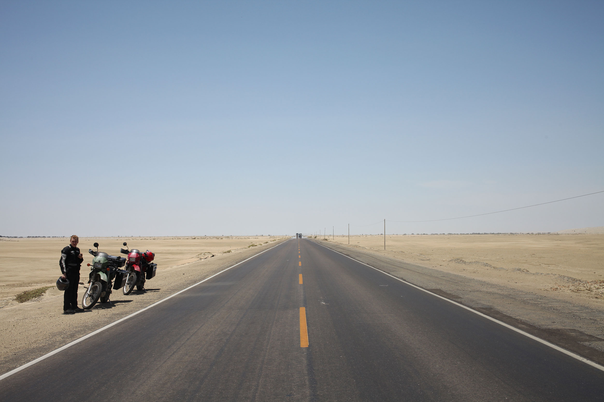
We stopped for a quick photo break 200 miles(isn) north of Lima. We were tired and dehydrated when we finally arrived although this desert is not actually that hot. Photo: Alex Washburn
What some people might not realize about this trip, or any trip on motorcycles, is that there are days where all you do is get up, and ride. It’s not a complaint, we have seen some of the best sights while on two wheels, but it is a reality I don’t think many people grasp. Riding into a town at dusk, looking for a hostel with parking (something you never worry about while backpacking), and only thinking about how much your ass hurts and that the overpowering, sometimes rancid, smell of your riding suit permeates every breath.
Get up the next morning, pack the bags, grab a bite and jump back on the bike for another full day. The dunes continue, going through small towns on a two lane road, dodging trucks and tuk-tuks. The sun is high in the sky, then low, then setting. The haze of evaporated water blends sky and earth and sand and road. A water color painting of a landscape that has no outstanding features. And we ride.
Nathaniel never takes photos of me so here is a selfie I shot with a 40mm. You’re welcome. Photo: Alex Washburn
Get up, pack, no breakfast, on the bikes. We make it to the ocean, dunes that lead right to the break. The towns become further apart. Stop when you can for food, for gas, for a break from the bike. Then more riding. The mirages stretche ahead, endless pools of nonexistent water, reminding you of the heat and the sand and the sun beating down. Sweat pools in your underwear, you can feel it every time you shift weight on the bike.
Even slight changes in scenery were exciting during our 700+ mile ride through the desert. Photo: Nathaniel Chaney
Its near the end of the third day that we hit a true stretch of freeway, not a two lane road, but an actual freeway and we twist the throttle and really open the bikes up. Ripping through the dunes, and the mountains of trash. What makes northern Peru look like a post-apocalyptic nightmare are the mounds of trash, which are usually on fire, that accompany the exit of every city.
Trash as far as the eye can see, with huts scattered throughout where people live and sift through the garbage. And then back into the desert of Mad Max the road warrior. The wind picks up, you tilt the bike, feel the sand sting that one spot your gloves and jacket have left unprotected. And the sun sets.
The final days ride brought us to Lima, our goal for the first leg of Peru.
Peruvians favorite part of the car is the horn, which they use instead of brakes or signals to inform others of the haphazard driving maneuvers they will perform that would churn the stomach of even the most talented of stunt drivers. Traffic be damned, Alex maneuvered us through the honks and sirens and shouts to our hostel, for a couple of days rest and some sight seeing before we get back on the bikes.
