Where the Autopista Ends
Two motorcycle bloggers in the San Francisco Bay Area.
The Road Less Traveled…
Posted on March 17, 2014
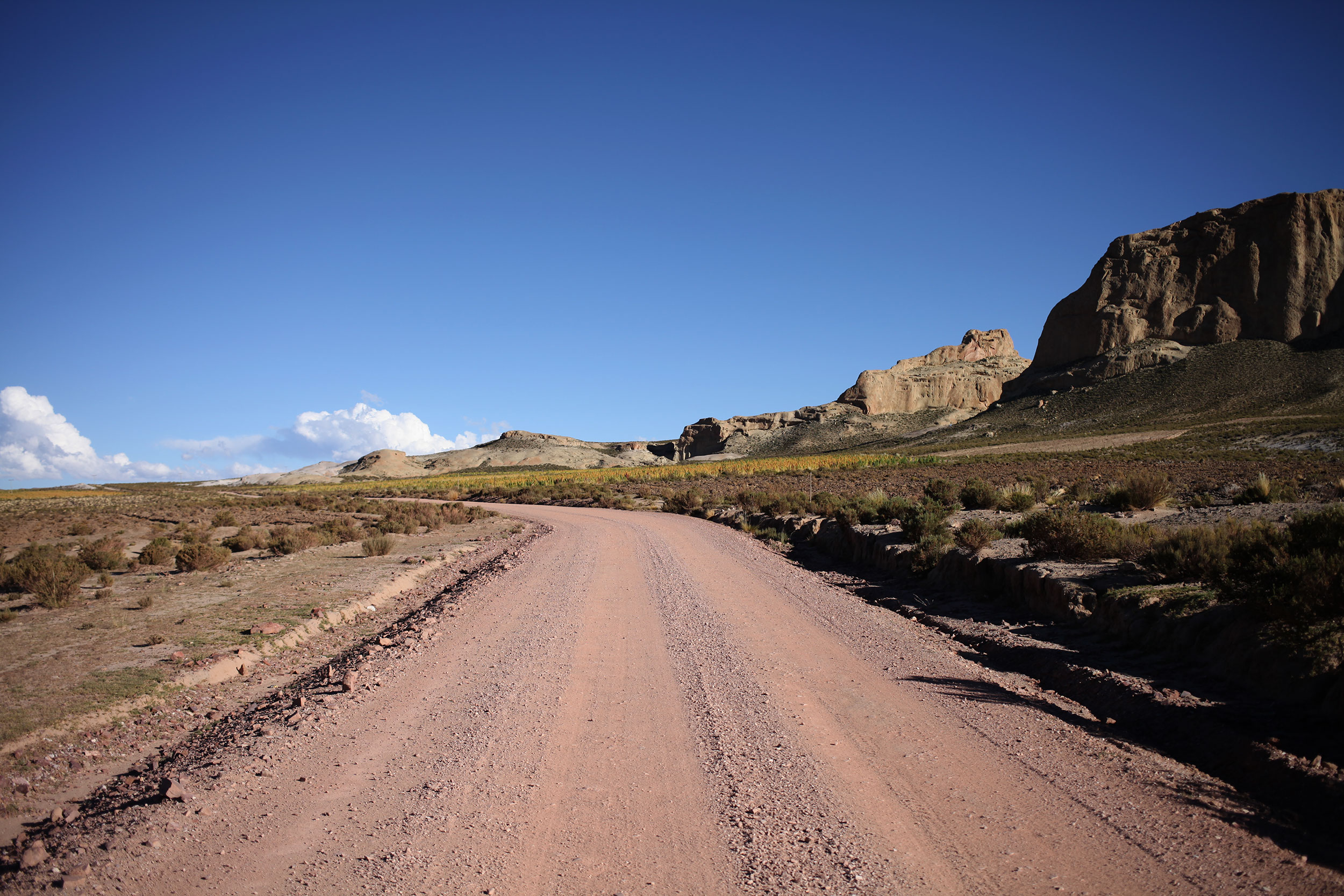
The road from Uyuni to Tupiza Bolivia was deceptively vicious. 120+ miles of gravel, sand, undulating ripples and very few people. Photo: Alex Washburn
For a reason…
In Bolivia I started asking the owners of hotels (using Alex translate their responses) how long it would take to get to the next stopping town we had decided on. Why? Because in Bolivia there can literally be nothing for miles and miles and I wanted to make sure that we made it to the next destination without running out of gas or having to drive long distances at night.
I accomplished only one of these goals when we set out from Uyuni to Tupiza after our day in the salt flats. I had asked the owner of our hostel the night before how long it would take to get to Tupiza, as we were planning on crossing the border to Argentina the next day. She responded that the road between the two cities was bad, mostly gravel, and that it might be better to back-track to Potosi and then head down from there as it would take 4 hours from Uyuni straight. A total of over 600km (roughly 372 miles) for the back-track, when the road that went straight there was only around 200km (or 130 miles).
Alex and I had been told by Google maps not to take certain sections of road and to instead do these long loops, but as of yet, we had’t encountered anything the bikes (or us) couldn’t handle. The worst was the road between La
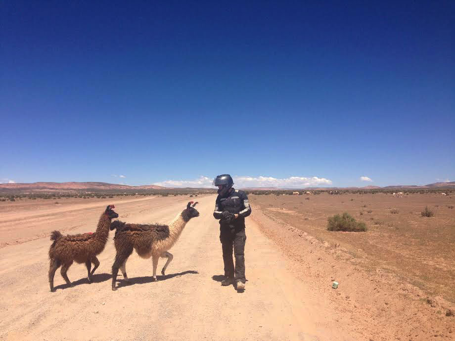
I was laughing so hard when these lamas started following Nathaniel that tears were running down my face. I quickly pulled out my iPhone to take pictures. Photo: Alex Washburn
The next day we got up, got packed, didn’t take showers because the element in the water heater was broken, and headed out after having some breakfast (our last meal until 9:30 that night) and spending a half an hour looking for gas, in a town that isn’t any bigger than a four or five street grid.
By the time we got onto “highway”-21 it must have been close to 10:30, not the earliest start to the day we’ve had on the trip. Highway-21 was never asphalt, not even in Uyuni, and about ten minutes in I gave up on it ever being asphalt for the entire length of the drive.
The first half was boring landscape you can’t be excited about going ten to fifteen miles an hour through. Llamas littered the sides of the road, while bumps caused by rains, that make the road resemble monster truck tire tracks, made for a slow bumpy ride. Stopping for a moment to wait for Alex to catch up to me, and checking what appeared to be an oil leak on my front left fork, I stood up to see a mama llama and her baby starring at me.
Not knowing if they wanted to attacked or were simply curious, I backed away from them slowly and raised up on the balls of my feet and put my arms above my head (what I was taught to do in cub-scouts if you come face to face with a mountain lion) making myself as big as I could. All the mama did was look at me, blink, and continue forward as I retreated to where Alex had stopped some twenty feet back.
All in all they were just friendly, curious llamas not accustomed to seeing stupid motorcycle riders, in full gear, stopping on the side of the road. The mama even ended up nuzzling Alex’s hands as she tried and succeeded to pet her. Seeing as we still had an entire days worth of riding ahead of us we pushed on from the llamas, as they lost interest in us and went back to grazing.
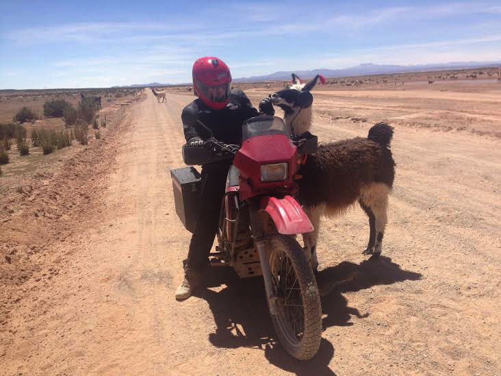
Alex makes friends with the rural lama. Photo: Nathaniel Chaney
Thinking the road couldn’t get any worse, it showed me a thing or two, by giving us sand on top of monster truck bumps, which helps to destabilize you better than anything we have encountered thus far (I almost tipped over more than half a dozen times that day, but was able to keep the bike up luckily). I went around one corner and couldn’t see Alex in my rear-view mirrors so I stopped to let her catch up.
However, after a minute of not seeing anything I knew something had to be wrong, so I flipped around and rode back around the corner to see Alex sitting on the side of the road, her bike smack dab in the middle of the sand on its side. I made sure she was okay before anything else, she replied that the sand was soft and she wasn’t going very fast when she fell, so we both went to lift the bike back onto two wheels.
It was at this moment that Alex realized that a cable was hanging loose, and upon further inspection, it had been held on by one of the sub-frame bolts. We don’t know how long she had been riding without it, but for those that don’t know the KLR, the back and front of the bike are held together by, you guessed it, the sub-frame bolts. There was no way she was going to be able to go another 100 miles on one sub-frame bolt without risking snapping the other and literally having her bike come apart into two halves.
There was a small cropping of buildings that some people might call a town only a couple minutes away, so we decided to get off the road and figure out a plan. Supposedly, according to locals, there was a larger town about ten miles away (though when your only going 15-miles an hour that can be almost an hour of riding) that we might be able to find a replacement at. However, I had read forums before we left where people had snapped sub-frame bolts and had a hard time finding replacements.
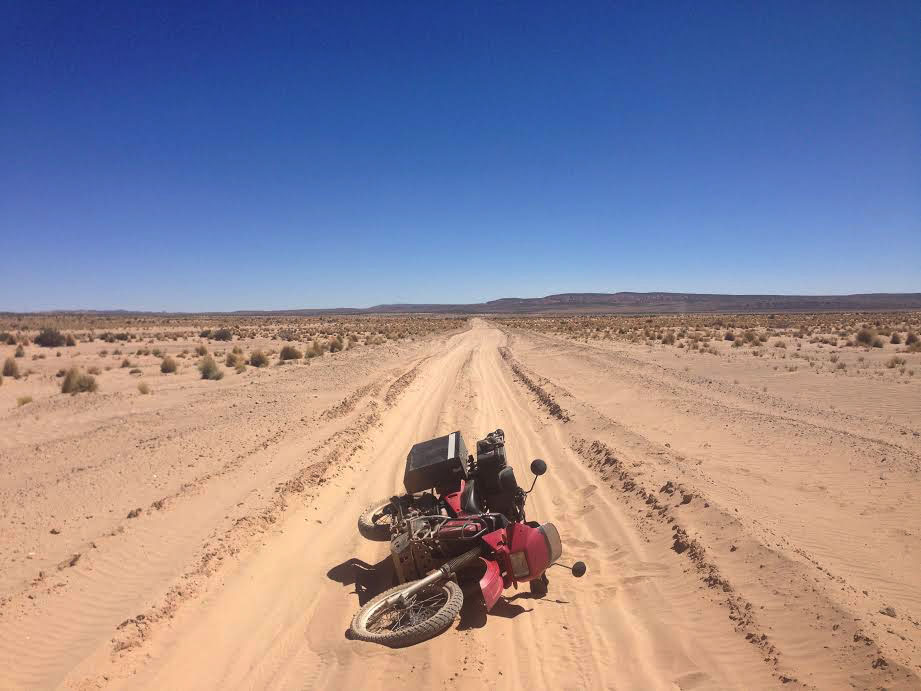
I can’t pick my motorcycle up without Nathaniel’s help while it has all my gear on it. Without the boxes I can pick it up but it’s still difficult. Photo: Alex Washburn
I’ll spare the details of the next 100 miles, and nearly 7 more hours of driving that occurred other than the important details. No more tip-overs by either driver, getting to the halfway point at 4:30pm, driving the last 40 miles in the dark, still on gravely dirt roads (they did get better in the second half, though still quite rocky), in the middle of the mountains with no ambient light say for headlights, smell of gas on my bike (to be covered later).
All in all, what the lady said would take us 4 hours took us ten plus hours to drive, the last three in the pitch black. Although, after driving the road all day and seeing how the Land Cruisers blast through it like they are training for the next Dakar we can totally understand why a local would think the trip only takes 4 hours.
Finally making it to Tupiza, we found an awesome hotel with parking and a restaurant right next store that was still open, again small miracles.
Even though we wanted to get to the border the next day, one of our bike gurus (Chuck Squatrigila) suggested we take a half day and check every bolt for looseness on the bike. It was a good thing he did. My bike was now leaking quit a bit from the left fork, but there was no mechanic in town who could do the repair, and it was looking like Salta, Argentina was the place to get it repaired. Though one mechanic in town told us it would be fine to drive on asphalt for another 1,000 miles (I don’t know if I believe that).
We found several loose bolts on both bikes, and the connections to my battery were loose (I lost electricity while parking that day, which made me think that might be the case). The big find on my bike was that gas smell I mentioned earlier, ended up being a hairline crack in my tank that was leaking a small amount of gas. Not to worry, Alex and I had prepared for everything (thanks to the help of many people) and we pulled out the tube of JB Powerweld, followed the instructions, and epoxied the crack right up. We checked to make sure it stuck and there were no leaks in the morning, good to go.
It was the hardest day of riding of the trip, but we both felt accomplished for tackling it and making it through, though I think are guardian angels took a couple blows that day.
Big Pictures Salar de Uyuni
Posted on March 13, 2014
We visited the world’s largest salt flat – Salar de Uyuni a few days ago before making a big push toward the Argentinian border.
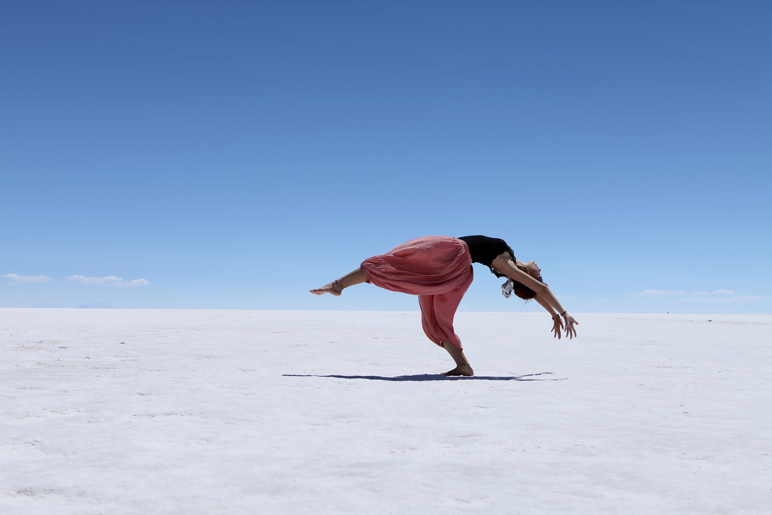
A Brazilian girl dances for her boyfriend’s camera on the Salar de Uyuni. Tourists usually bring props to play with the strange perspective the salt flat creates so I found this especially ethereal. Photo: Alex Washburn
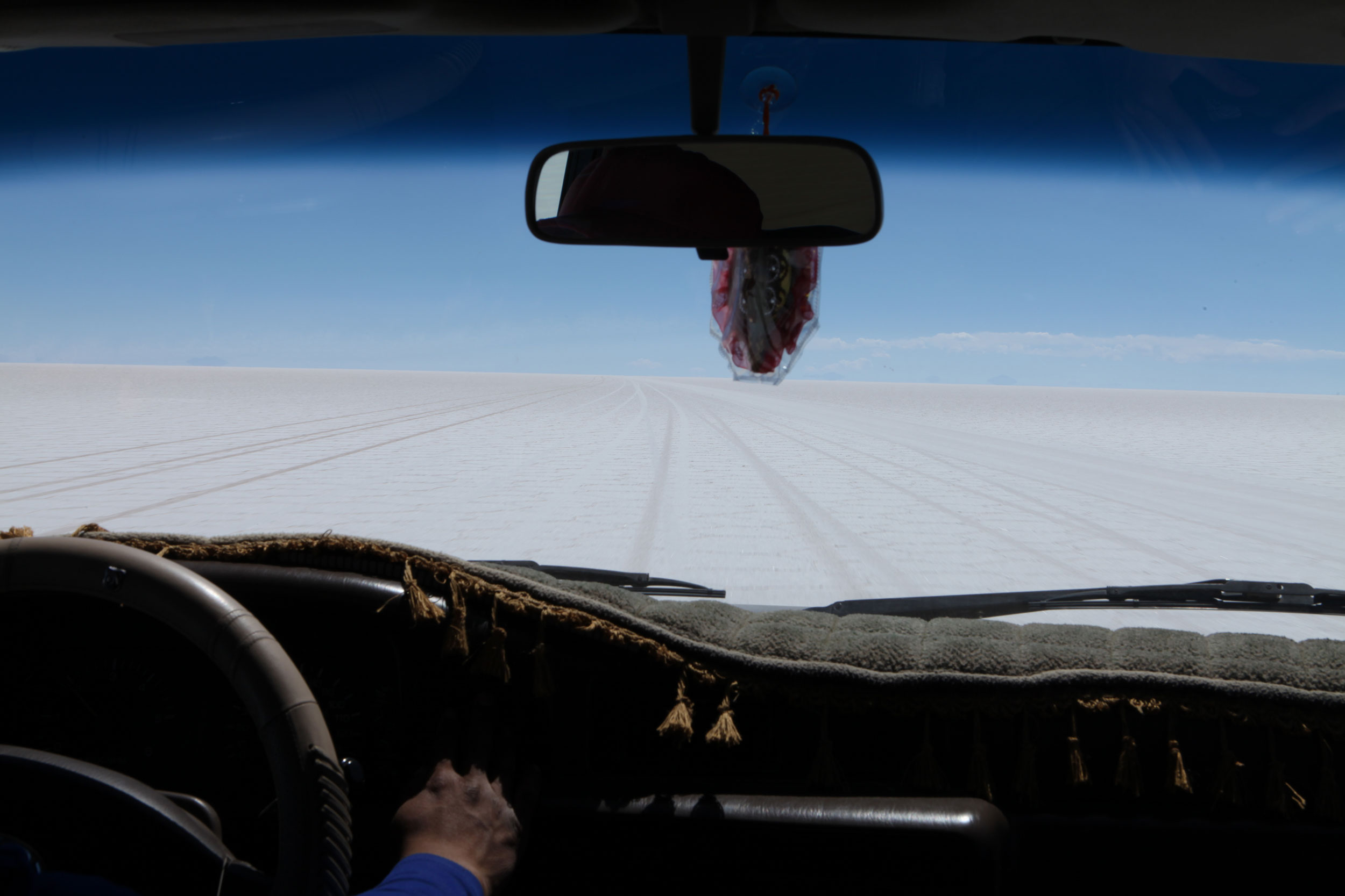
Driving through the Salar de Uyuni is a strange experience. White hard packed salt stretches for miles in every direction and the local guides navigate across the expanse of nothingness using the surrounding mountains as navigational markers. Once we got out onto the salt flat we were glad we hadn’t driven out there alone. Photo: Alex Washburn
Nathaniel decided before we had made it out onto the Salar de Uyuni that he wanted a photo for instagram of himself standing out in the middle of the salt flat ‘sin ropa’. The other people in our SUV thought this was hysterical. Nathaniel was the only person in our car of 8 who did not speak Spanish so this was his bonding moment with the others. Photo: Alex Washburn
There are two ‘islands’ on the Salar de Uyuni. We paid our 30 Bolivianos to walk around the Isla Incahuasi and the desert flora made a strange contrast to the smooth expanse of white surrounding it. Photo: Alex Washburn
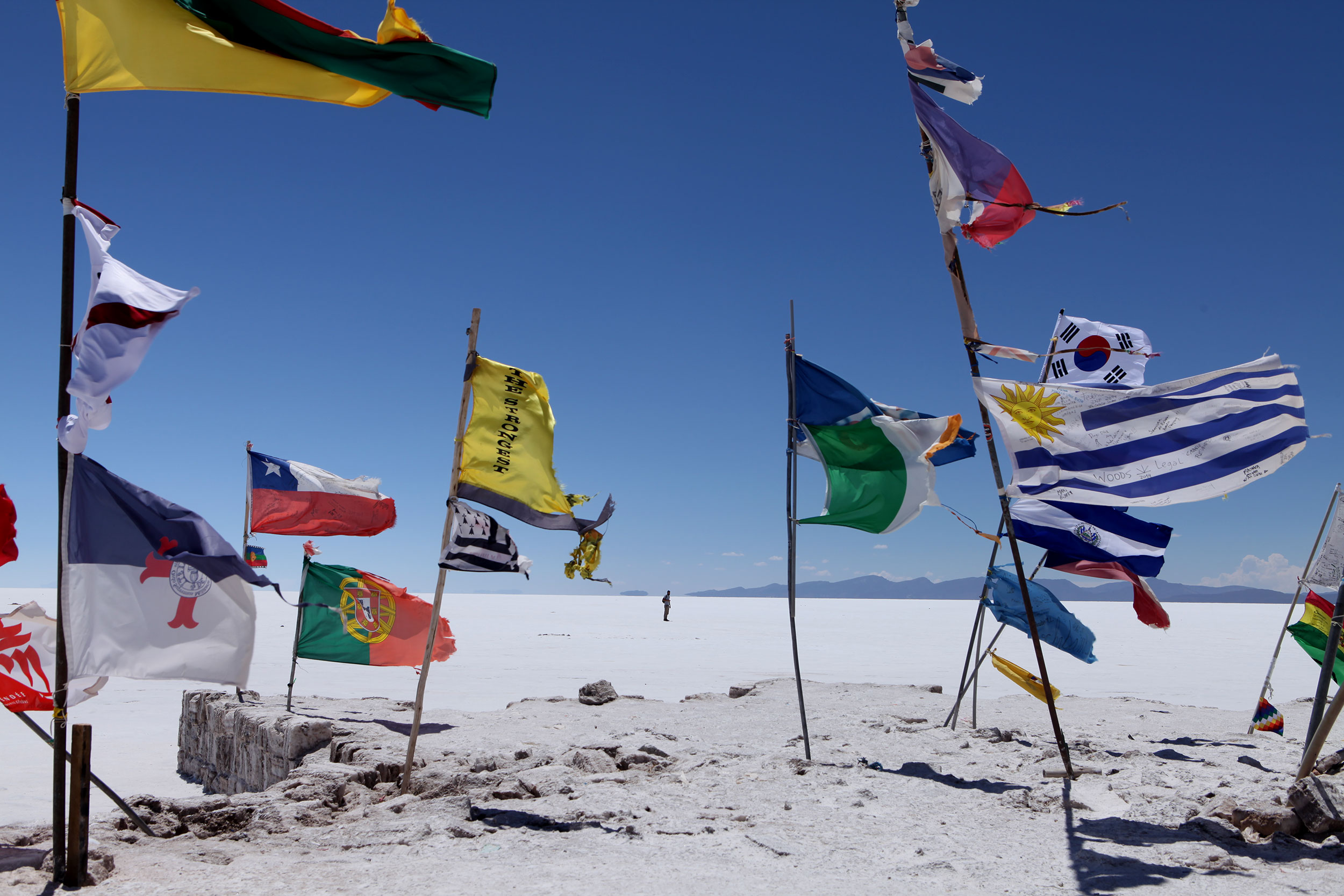
If you visit the Salar de Uyuni I would suggest bringing a flag to add to the collection near the buildings where most of the tours stop for lunch. The fluttering colors are gorgeous against the the duo-chromatic surroundings. Photo: Alex Washburn
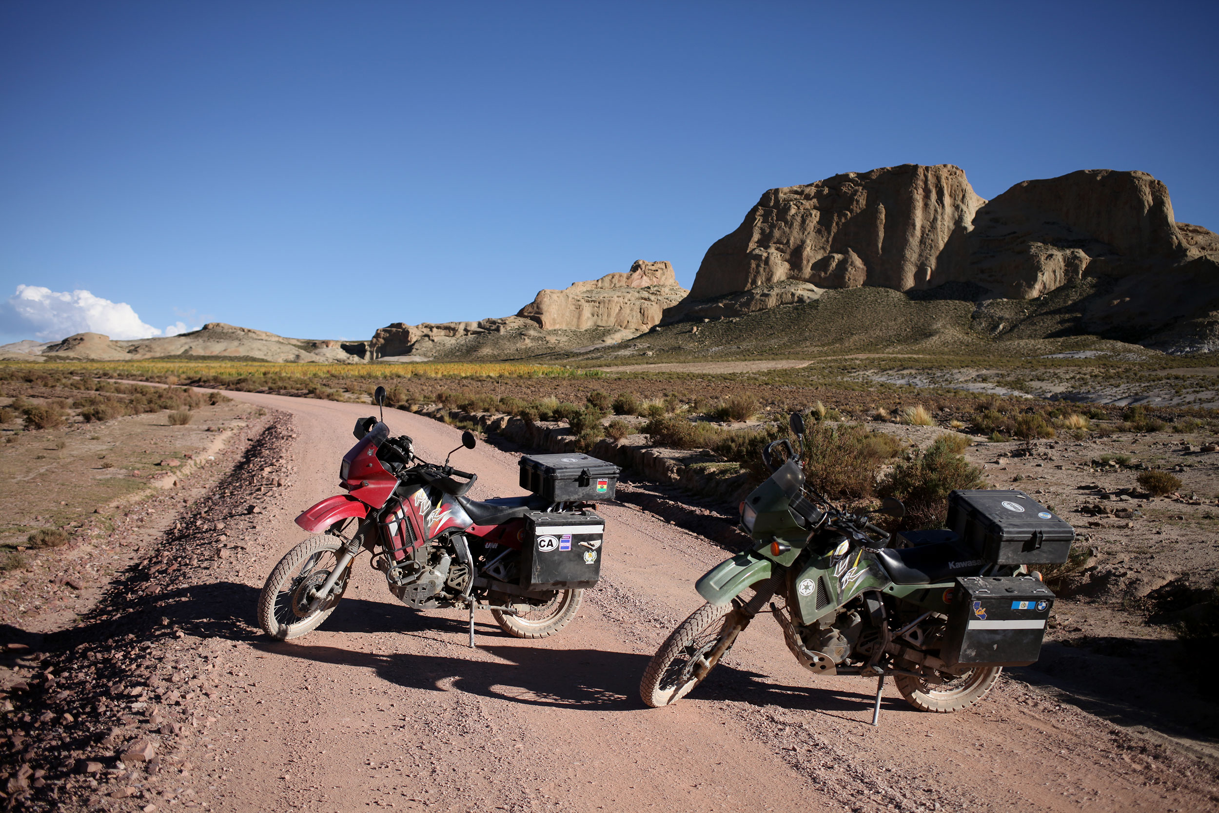
After touring the Salar de Uyuni we were ready to pack up and head south once again. Here is a photo from the road between Uyuni and Tupiza which will be covered in depth in the next blog. Photo: Alex Washburn
The Bolivian Death Road
Posted on March 9, 2014
The view from the top of the Bolivian Death Road. Photo: Alex Washburn
The Bolivian Death Road lives large in the minds of ADV riders. It was crowned the world’s deadliest road in 1995 and the nearly two decades since hasn’t tamed the curvy unpaved beast.
When we first left the United States, riding the Bolivian Death Road aka Camino de la Muerte aka North Yungas Road wasn’t on our itinerary, but somewhere along the way Nathaniel decided he wanted to do it. Somewhere along the way he got sucked into the macho idea of riding the death road and the fact that all the other boys are doing it.
I agreed to go, with some reservations, although I wouldn’t say I was afraid. However, I probably wouldn’t have gone out of my way to do it if I was on my own.

Our couple photo on the Bolivian Death road. Photo: Alex Washburn
We woke up early in La Paz and pulled on our riding suits before heading out into the crisp morning. The start of the death road is approximately an hour ride outside of the Bolivian capital and a giant yellow sign greets you on an uneven gravel turn out just off highway three.
We parked our bikes and then walked over to a bench-sign combo that gives a brief history of Bolivia’s most infamous 60km stretch of gravel. I learned standing there that the road was constructed by prisoner’s of war, it is often foggy along the route, and that ever since it earned the title of the world’s deadliest road it has been a huge tourist attraction (especially for mountain bikers).
The sign also spells out the rules of driving the death road. Because of its form you must keep to the left hand side of the road and vehicles moving up the hill have the right of way. Accidents usually happen when two cars meet at a narrow point and the uphill vehicle must back up- tires can easily slip over the edge of the cliff.
(According to wikipedia several hundred people die on the road every year, but I think those numbers are grossly inflated.)
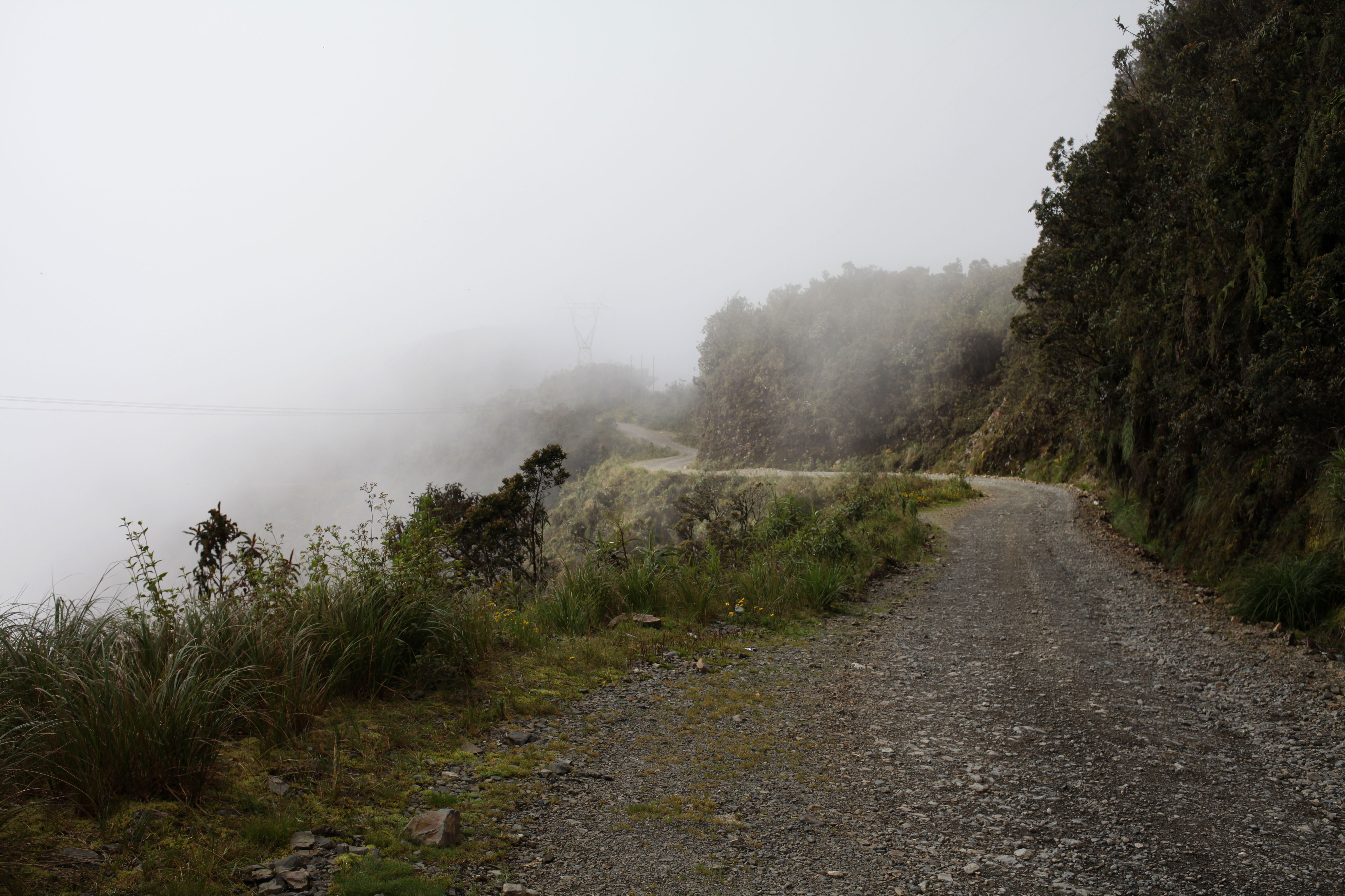
We couldn’t see very far down the path because of the fog drifting around and after taking the obligatory photos of the sign and the entry point we hopped back on the bikes and headed off into the mist.
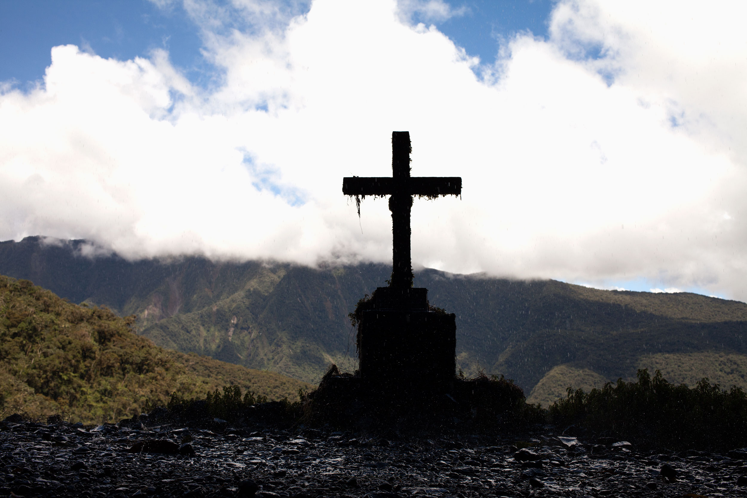
A cross marks where people have died on the Bolivian Death Road near a series of small waterfalls. Photo: Alex Washburn
Most of the death road was not technically difficult riding, but the idea that around any blind turn could be a truck keeps you on your toes. Thankfully, we only met one vehicle going the opposite direction and it was on a portion of road where I could safely stop and let him pass.
For us, the most memorable part of the road was the portion where you ride on very uneven wet rocks beneath several small waterfalls (getting wet) and pass a solemn grey cross marking where people have died. The section is roughly 300m long and it is a narrow piece of work with a sheer mossy rock wall on one side and a lush green cliff dropping off the other into only god knows where.
The camino de la muerte was not nearly as tough as I thought it would be and if I had to make a list of the top 5 rides of the trip so far it would be on it.
Check it out:
